January 1957 Flood One of the Worst in History
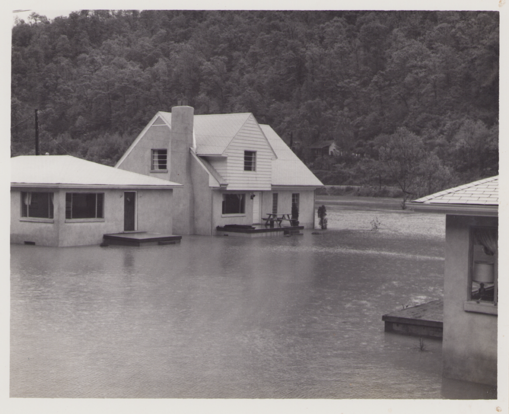
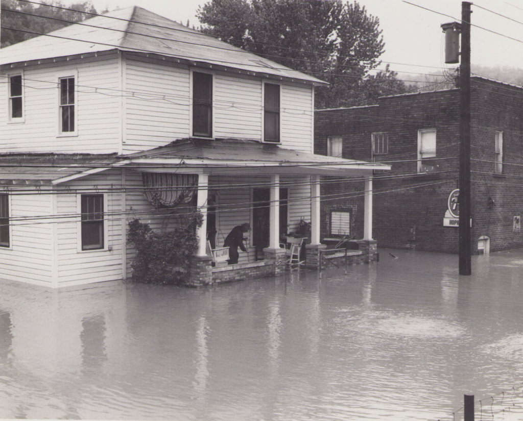
The January 1957 flood dealt Eastern Kentucky a severe blow: it took 12 lives and caused $50 million in damage.
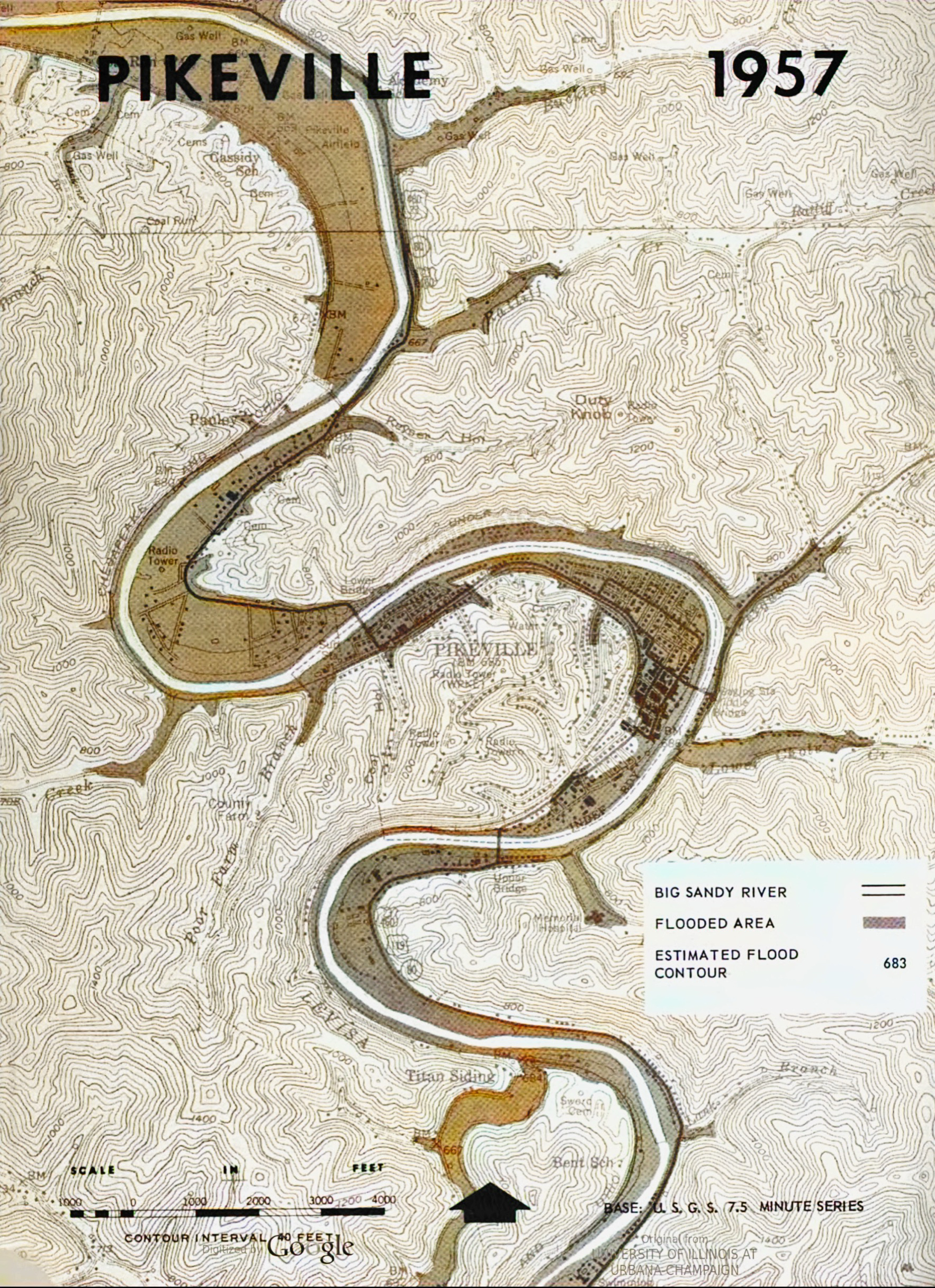
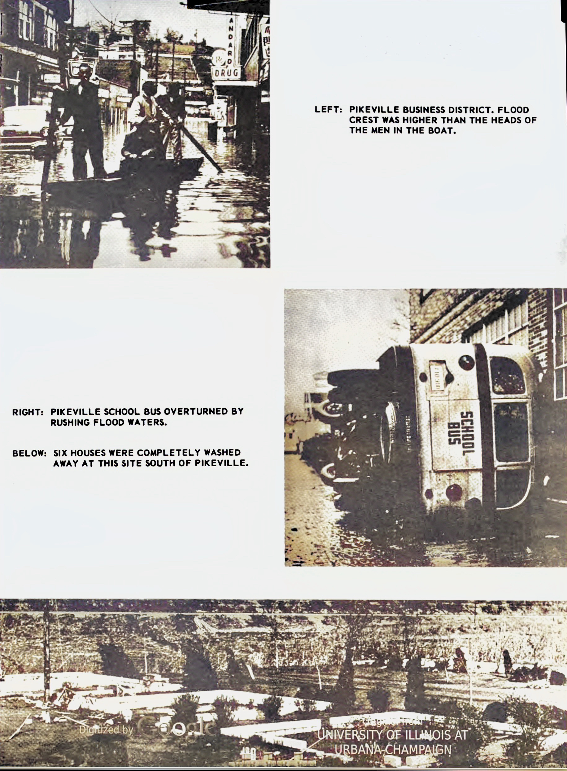
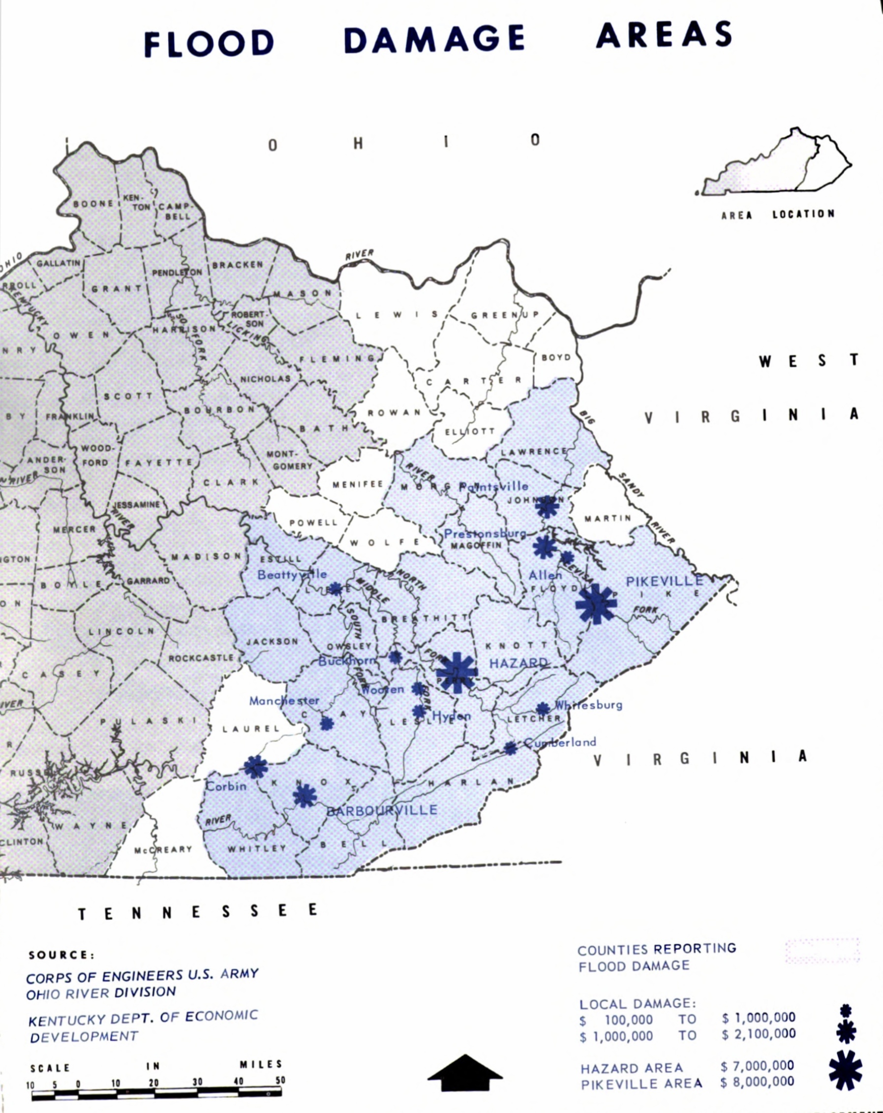
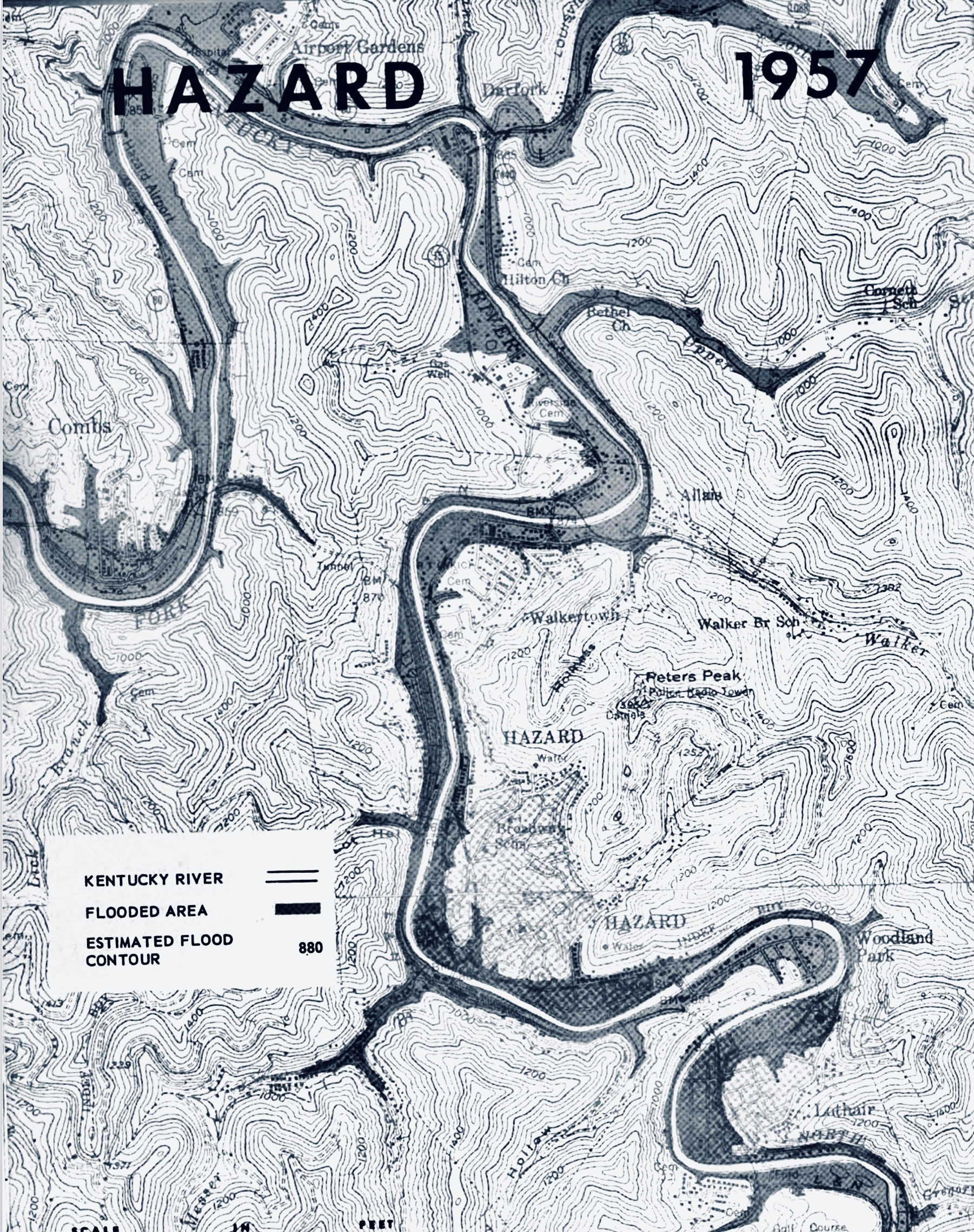
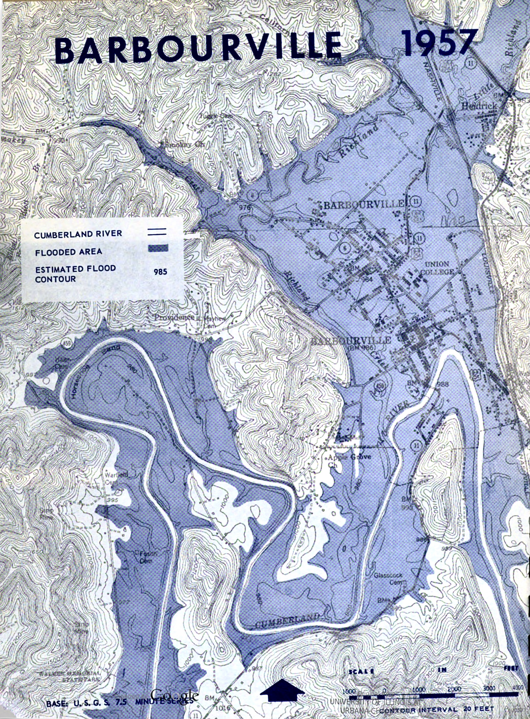
The mid-winter flood of 1957 wrought great destruction in the Big Sandy, the Kentucky, and the Cumberland river valleys. At Pikeville on the Big Sandy River over $8.5 million in damage was recorded. At Hazard on the North Fork of the Kentucky River an estimated $4.5 million worth of damage was done. At Barbourville on the Cumberland River flood damage figures exceeded $1. 3 million. These are only instances. The January flood caused an estimated total of more than $50 million worth of damage in Eastern Kentucky, 80 per cent of the dollar damage in the entire four-state area affected.

1957
Flood Reached Record Heights
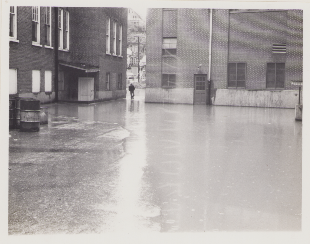
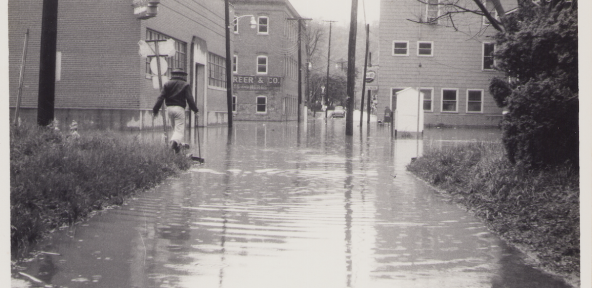
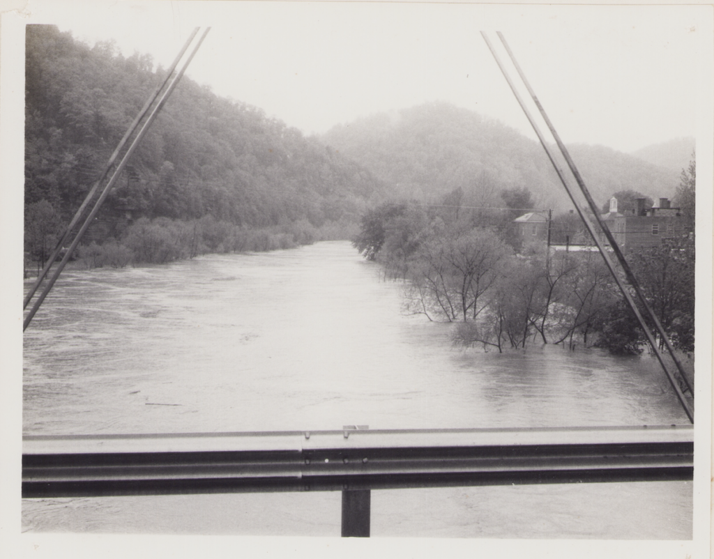
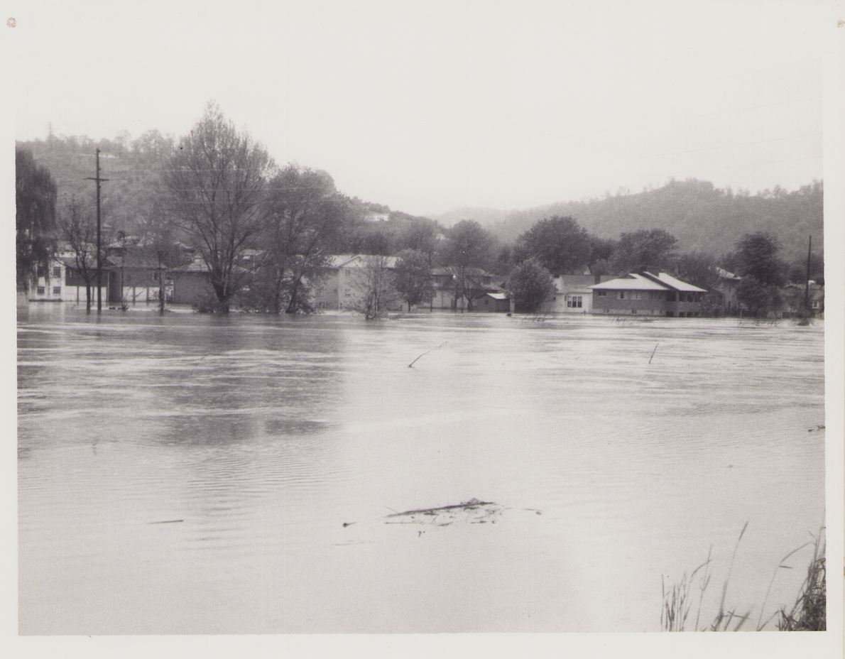
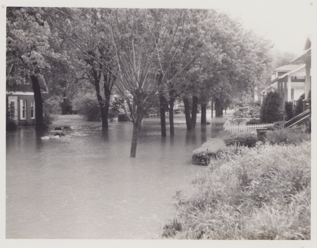
The flood of January 1957 was an extremely violent example of the type of flash flood common to the upper reaches of the four major rivers that rise in the mountains of Eastern Kentucky: the Big Sandy, the Kentucky, the Cumberland and the Licking Rivers. The flood reached record heights in many communities in the region and added to the extensive history of floods in Eastern Kentucky. Since 1862, ten major floods have been recorded, in addition to numerous minor floods.
Almost all of the principal cities of the region were flooded to some degree. The Licking River Valley experienced only minor damage although it has been subject to severe flash flooding in the past.

Twelve lives were lost in the region and nearly 10, 000 families received emergency assistance.
They suffered from exposure to winter cold and from lack of adequate food, clothing; shelter and sanitation.

Flood cleanup was a laborious and expensive task. The receding water left inches of mud on sidewalks and floors; flood debris littered streets, lawns and fields. The Commonwealth of Kentucky estimated the cost to the state for emergency relief at over $3.5 million. Over $3 million worth of food and other flood relief assistance was provided by the American National Red Cross and other agencies.
Additional amounts of cash and goods were contributed by private firms and individuals from many parts of the State and Nation
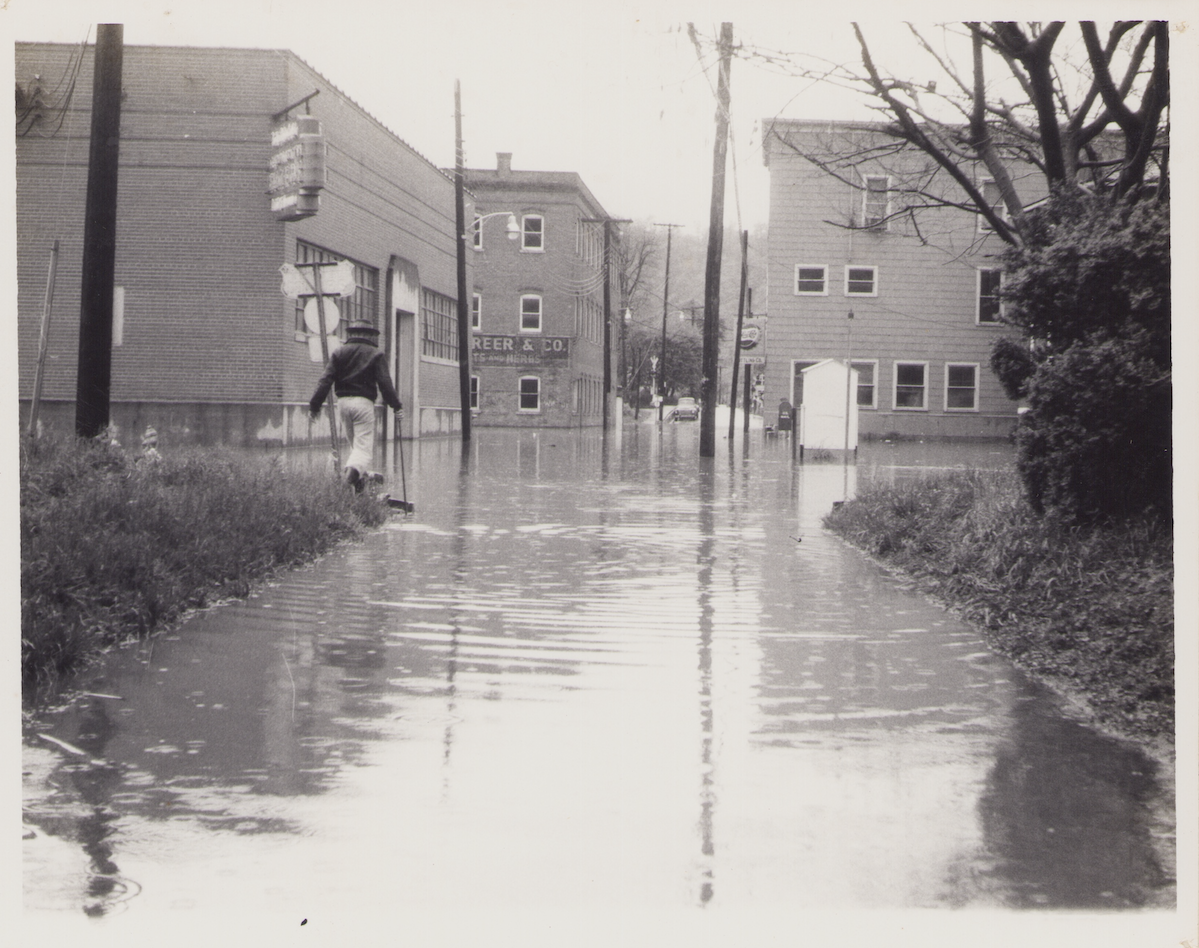
Because of the mountainous topography of the area, most Eastern Kentucky cities are located on bottom lands along the streams and rivers.Because of the mountainous topography of the area, most Eastern Kentucky cities are located on bottom lands along the streams and rivers.
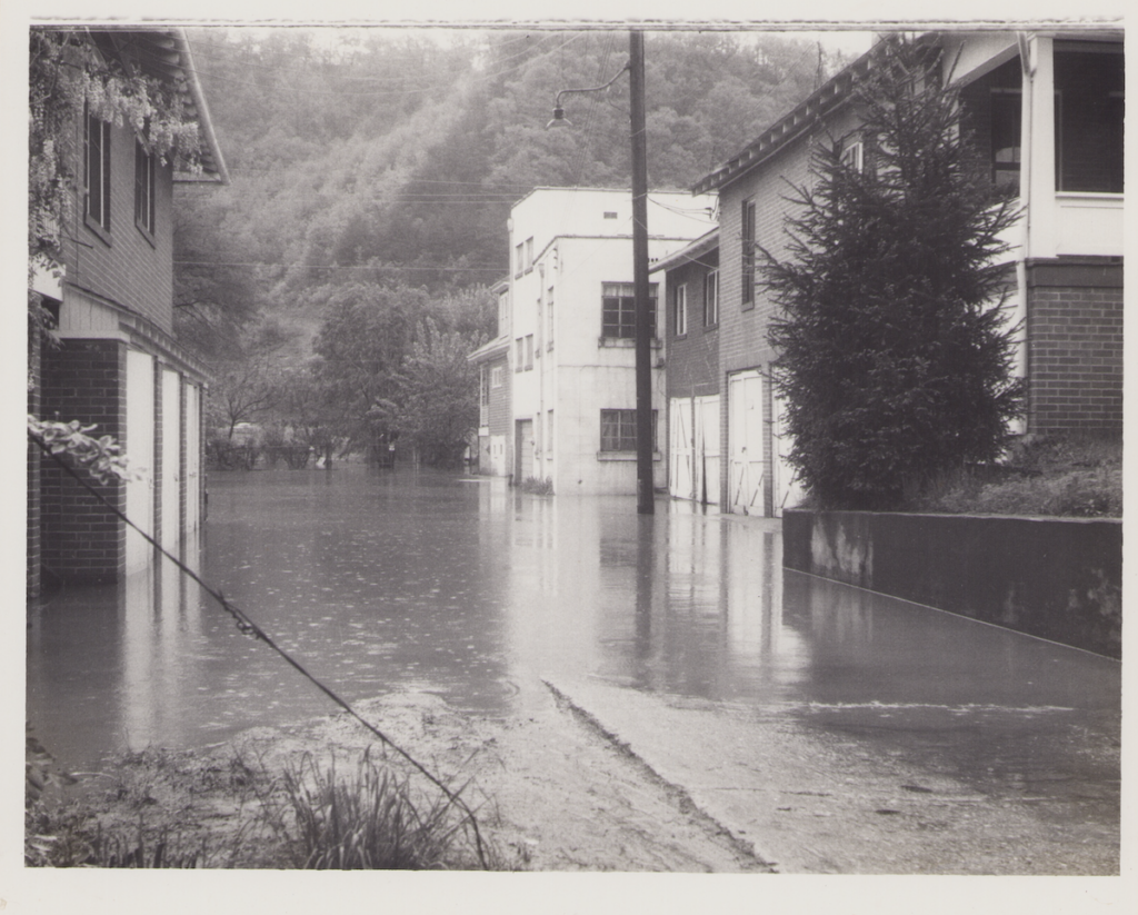
Because of the mountainous topography of the area, most Eastern Kentucky cities are located on bottom lands along the streams and rivers.
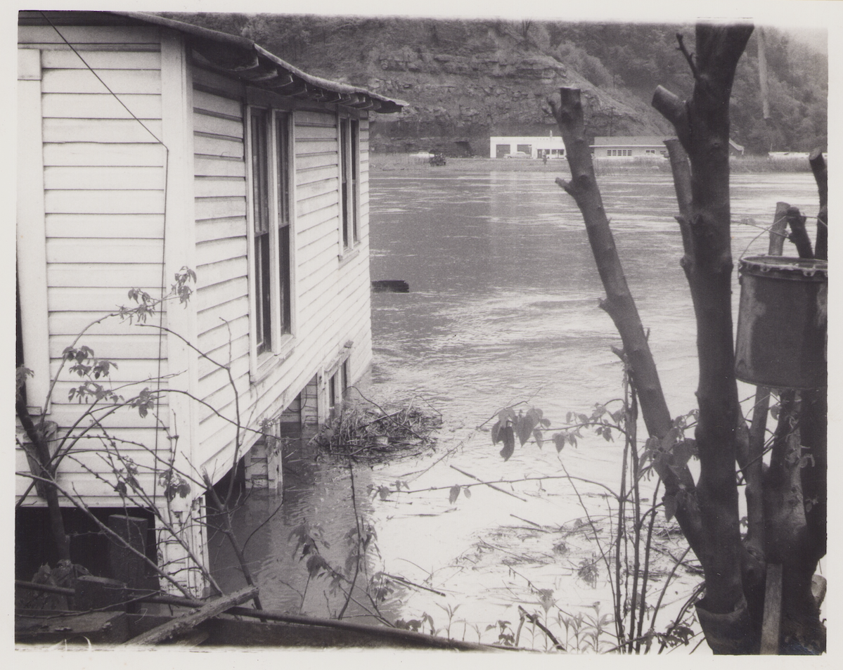
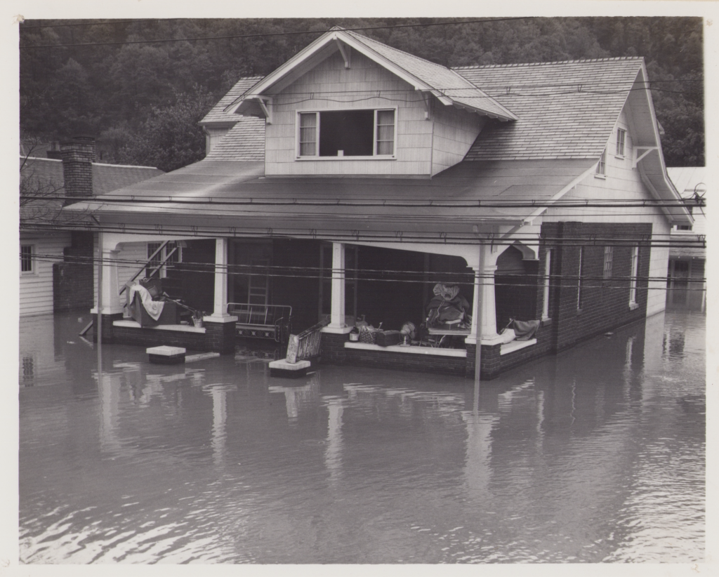
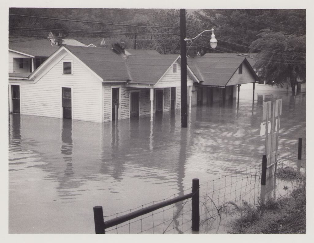
There is very little other land with slopes gentle enough to permit construction at low cost. With few exceptions, the bottom lands are subject to destructive flash floods, due to the nature of the terrain. In the January 1957 flood, houses were carried from their foundations and automobiles were overturned and smashed against buildings by the fury of the current.
Debris carried by the streams dislodged and destroyed bridges and riverside dwellings

Causes of the Flood
The flood of January 1957 was caused by heavy localized downpours on ground already saturated by days of intermittent rainfall. From the morning of January 27 to the evening of February 1, the amount of rainfall varied from 5 inches to over 12 inches in headwater areas near the Kentucky-Virginia border. The combination of steep slopes and high runoff rates resulting from pre-saturation of the soil concentrated the area-wide rainfall in the many steep and narrow mountain streams. The rush of water which poured into the main river channels from the many small tributaries rapidly filled them and poured over the riverbanks onto the bottom lands.
The most important single factor in increasing flood damage has been the continuing construction of buildings on the flood-plain in the natural floodway of the stream. Filling in of the river bottoms as well as partial filling of the river channels for road construction or for building sites has reduced main channel capacity in many locations. Restriction of flow at these points has tended to increase flood heights and flood water velocity.


I was only 6 but I remember