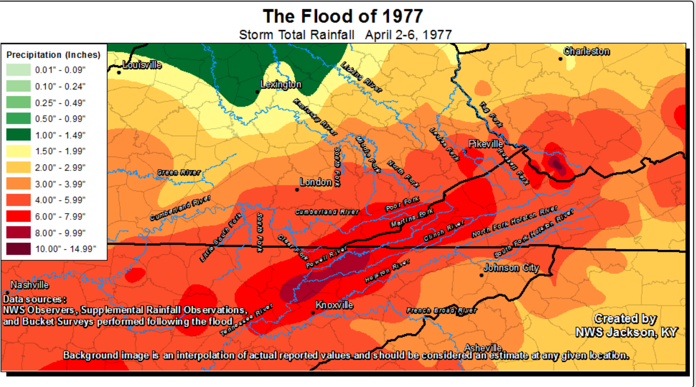
Twenty-two people died in the four-state region, including 10 in Kentucky, due to the flooding which also affected southern West Virginia, southwest Virginia and parts of Tennessee as the heavy rain continued through April 5.
According to the National Weather Service office in Jackson, record flooding occurred on the Tug and Levisa Forks of the Big Sandy River, the upper Cumberland River, the Guyandotte River, and the Clinch and Powell Rivers, with severe flooding also on the North Fork of the Kentucky River and on the Holston River.
The flooding led to 15 Kentucky counties being declared disaster areas, including Bell, Breathitt, Floyd, Harlan, Johnson, Knott, Knox, Lawrence, Leslie, Letcher, Magoffin, Martin, Perry, Pike and Whitley. Damage at the time was estimated at $175 million.
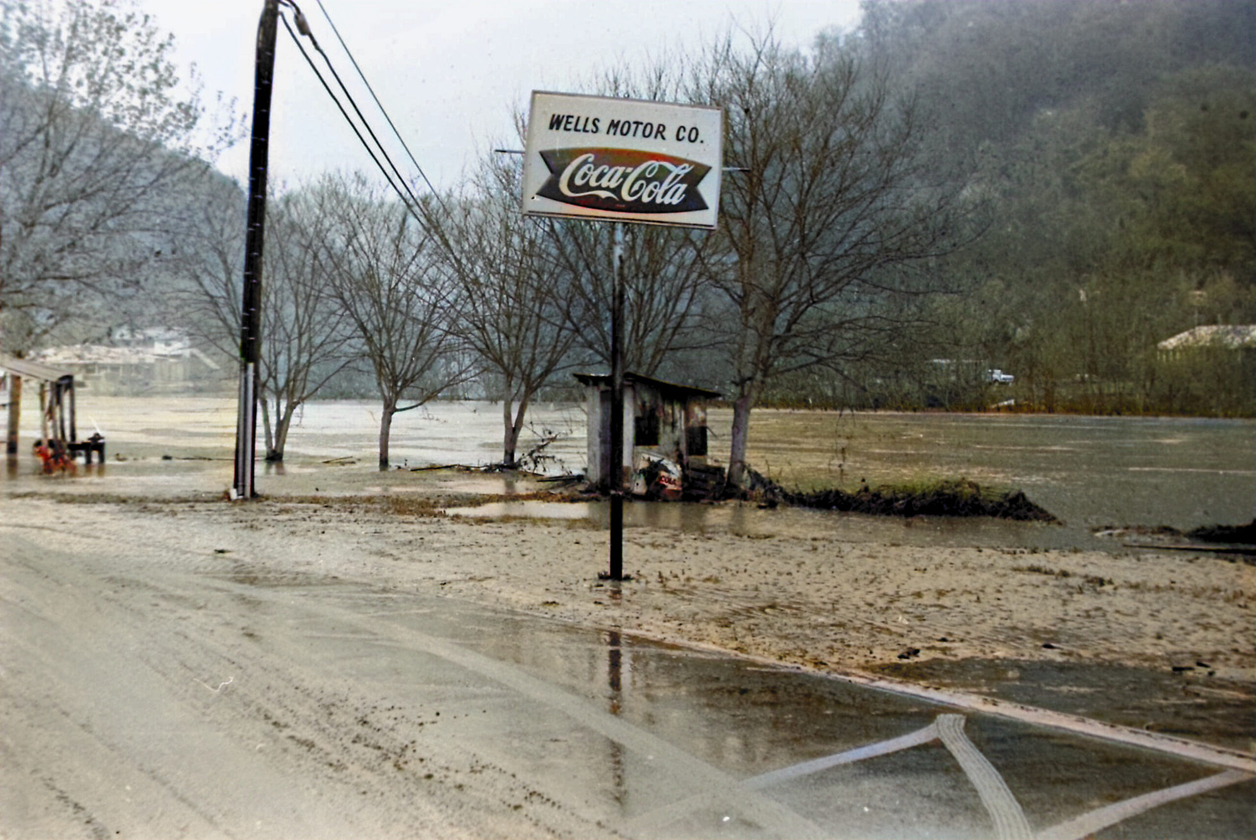
Major damage occurred along the Tug, Levisa and Russell Forks of the Big Sandy River. The city of Pikeville was estimated to have over $71 million in damages and lost revenue due to the flooding. Downstream in Floyd County, flood waters reached a depth of nine feet on Main Street in Martin, with one death, 117 businesses destroyed or severely damaged countywide, with nearly 1,000 families suffering losses.
Pikeville, April 1977
Photo courtesy of Courier-Journal

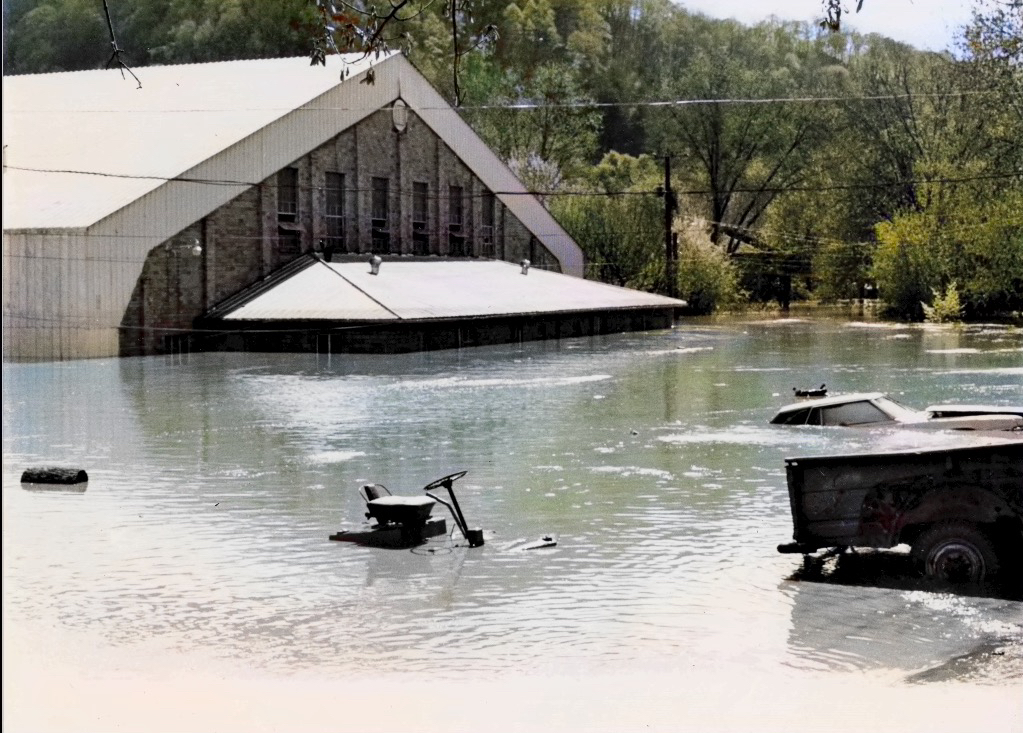
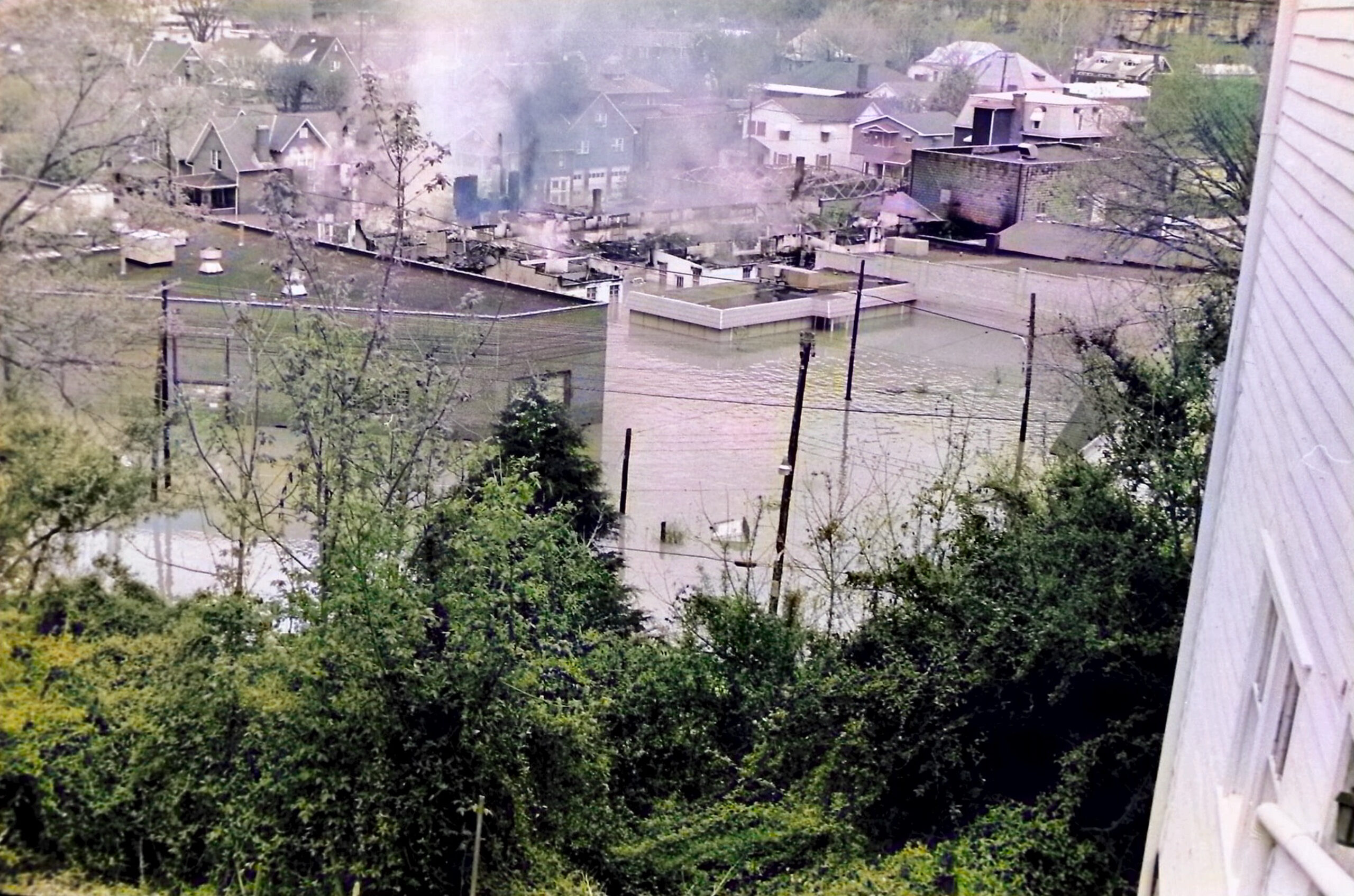
Pikeville High School, flood stage near crest.

Pikeville College Gymnasium


After The Flood Crest


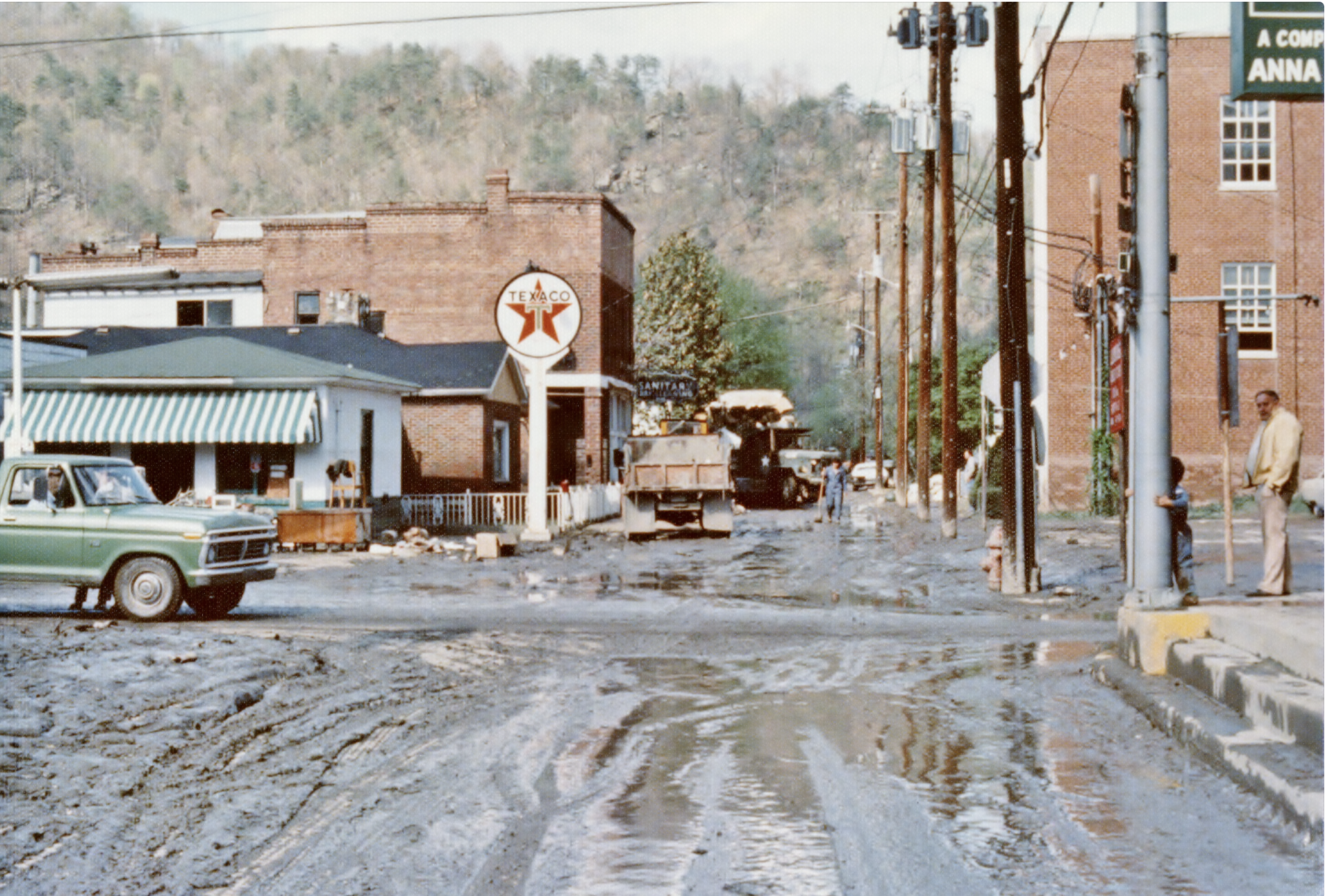
The Cleanup Begins, The Long Road To Recovery


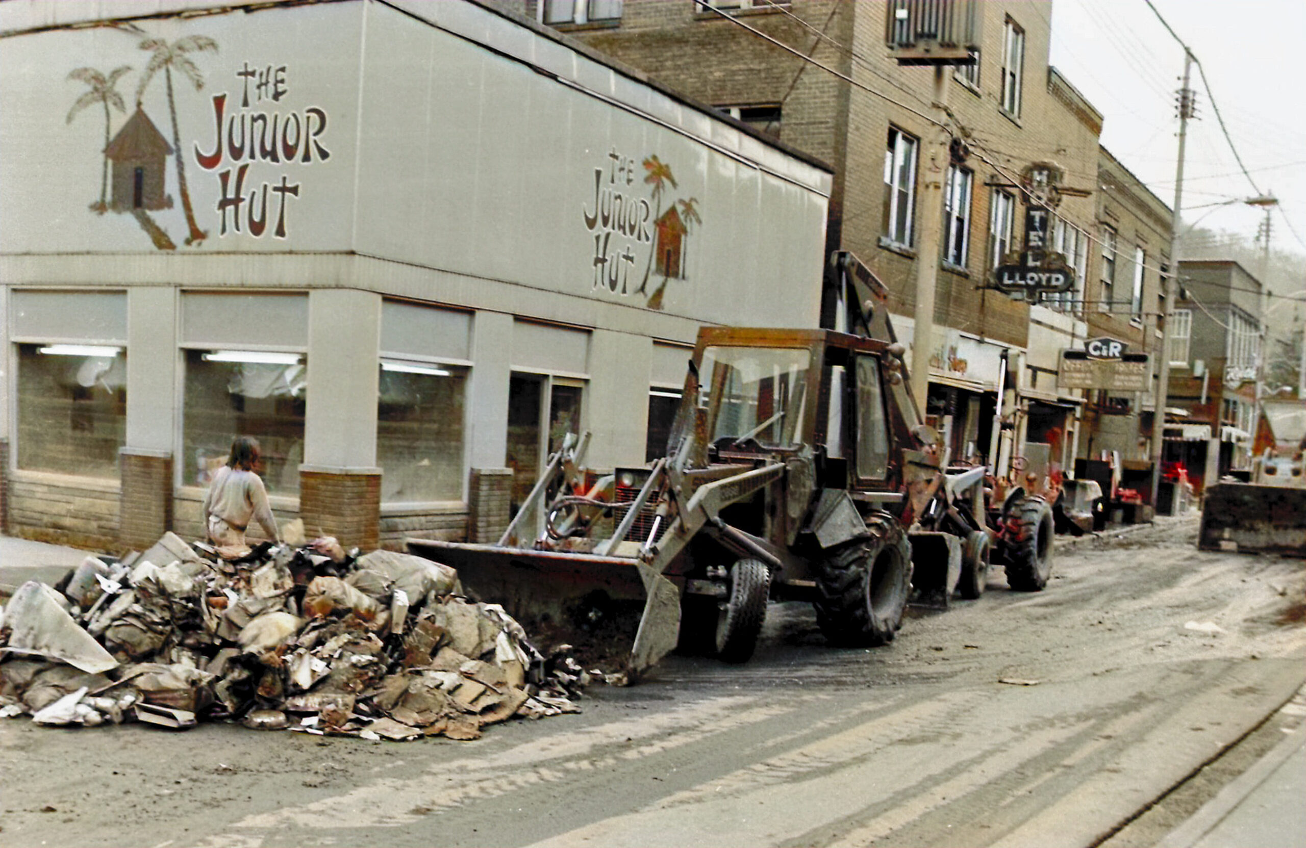
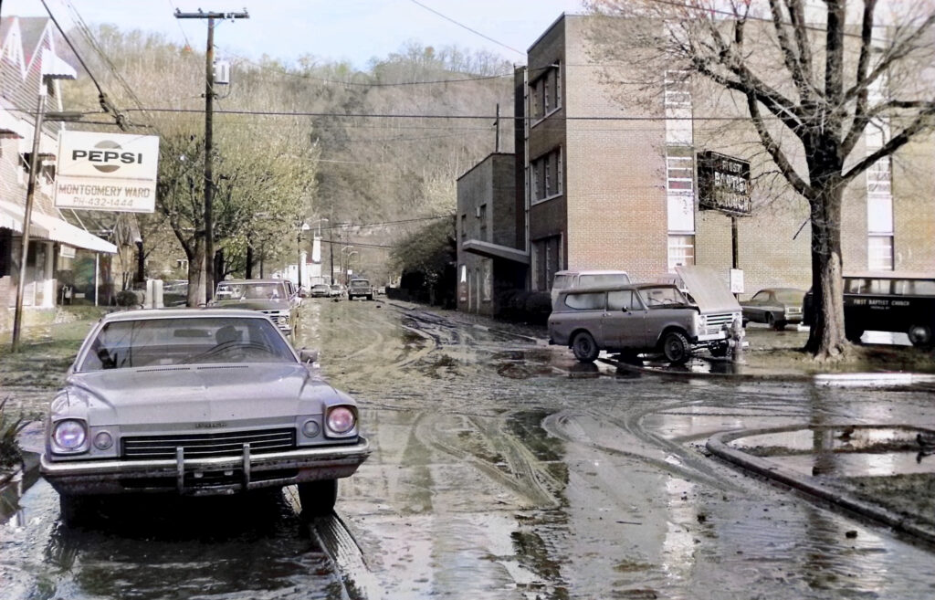
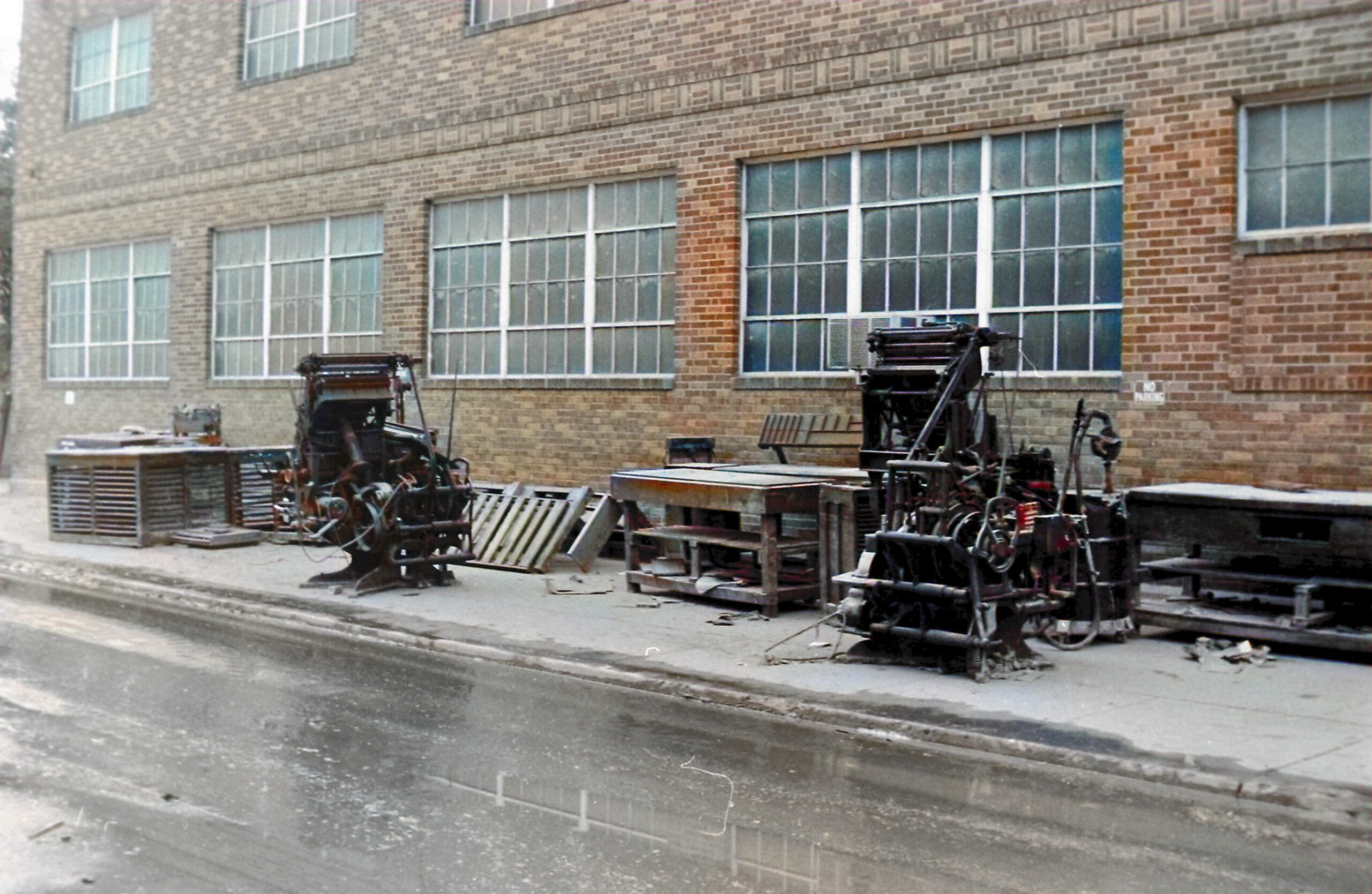


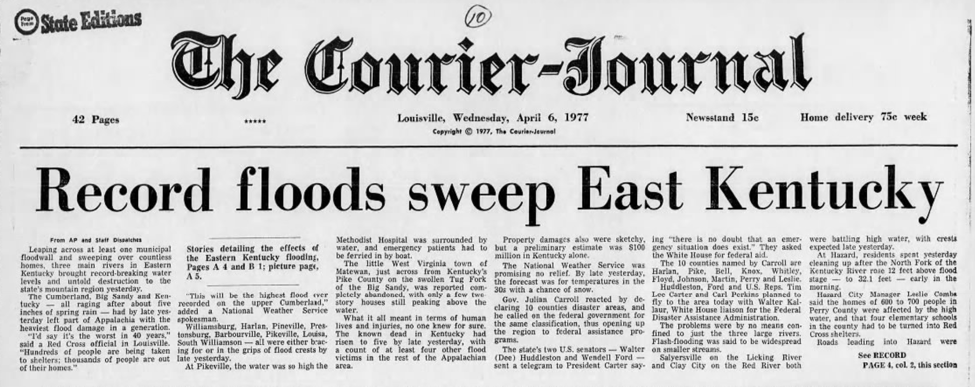


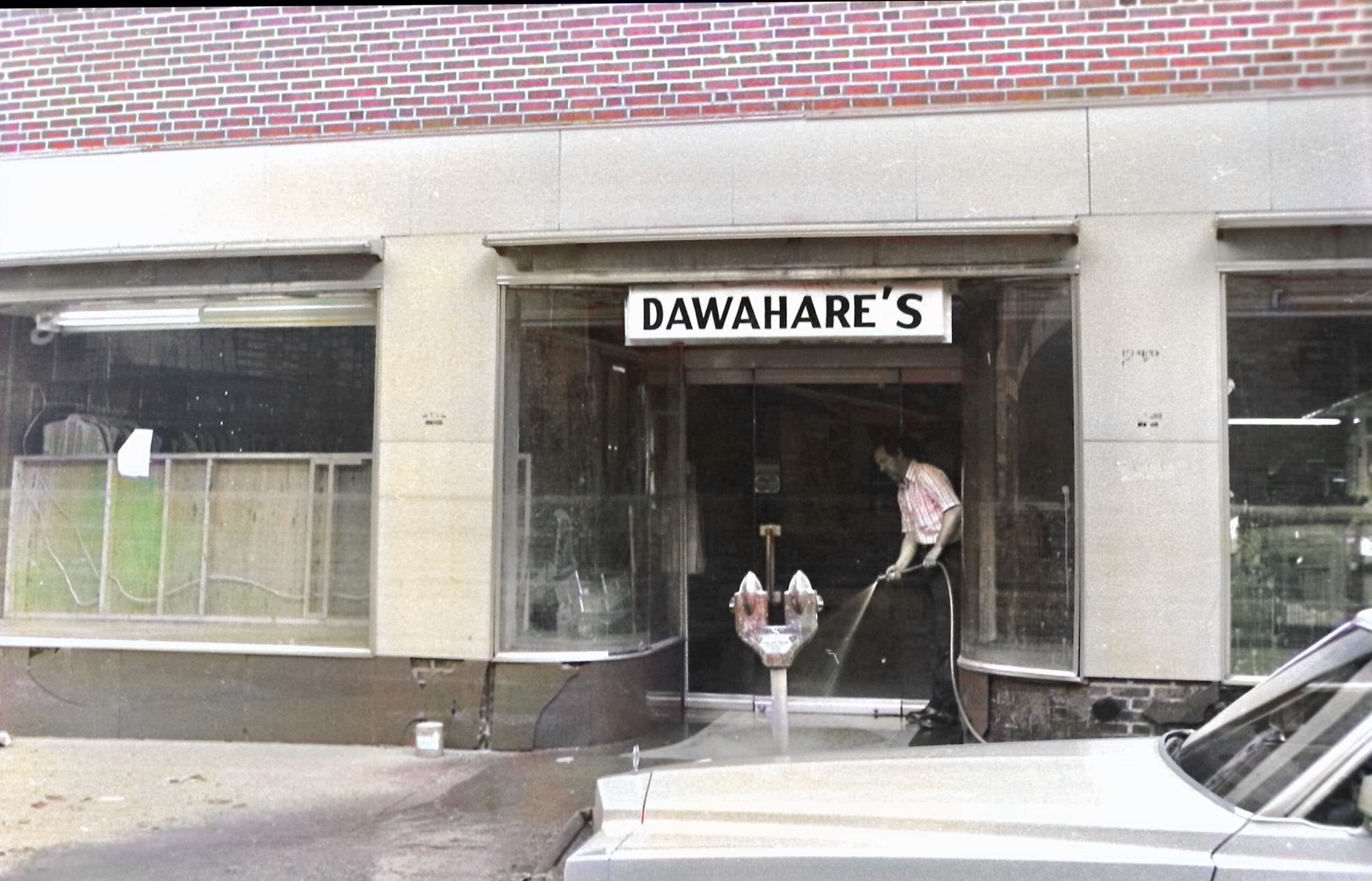
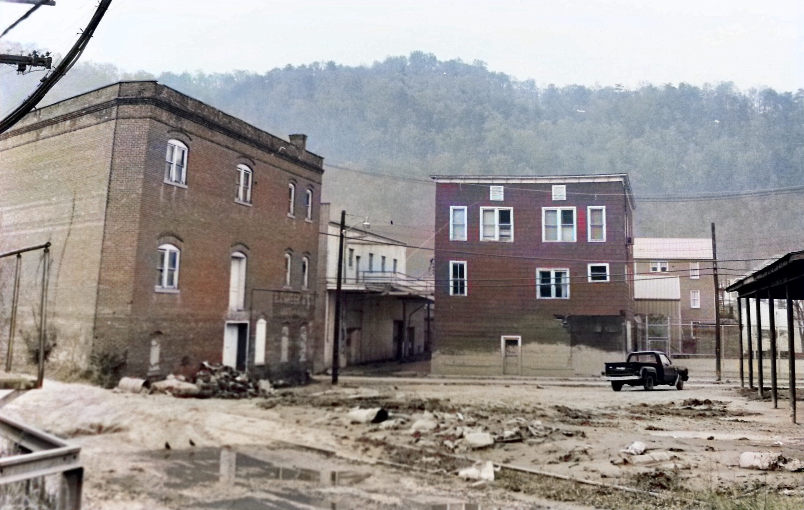
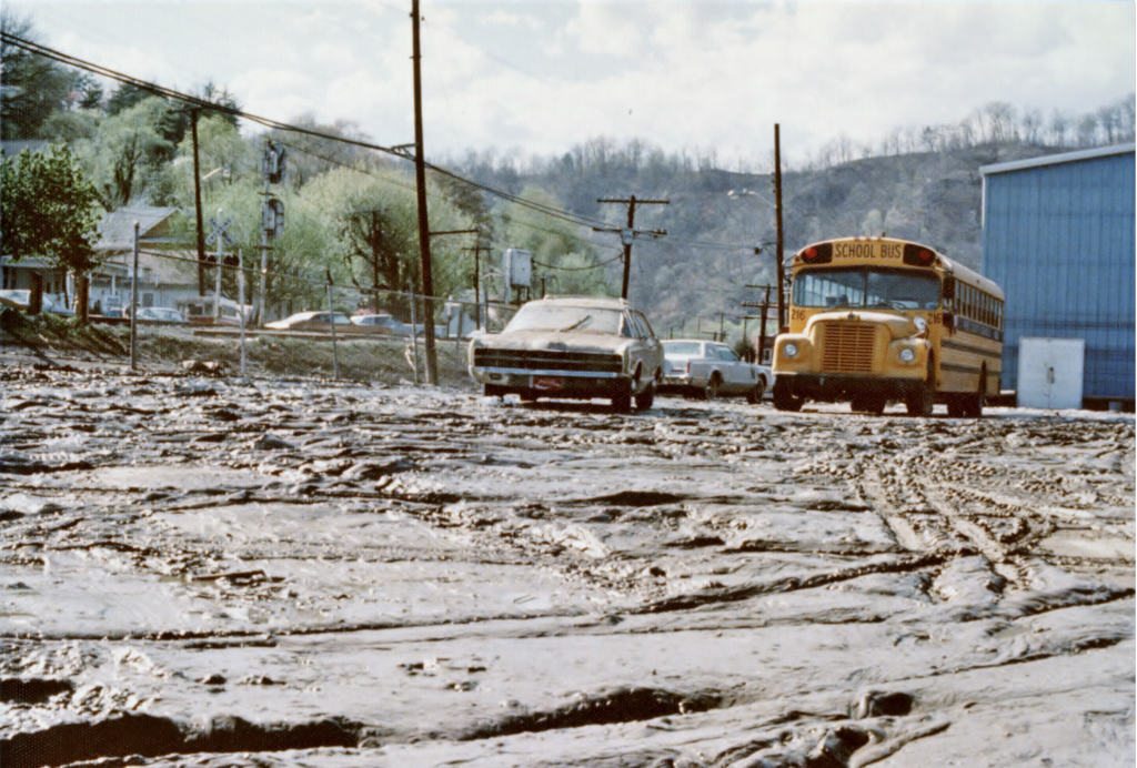
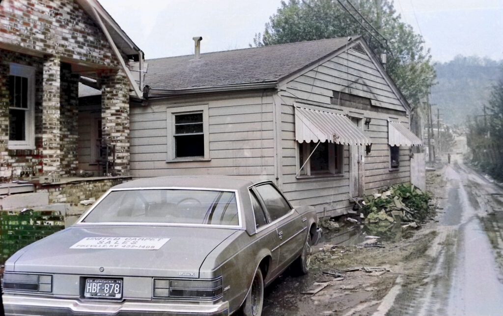
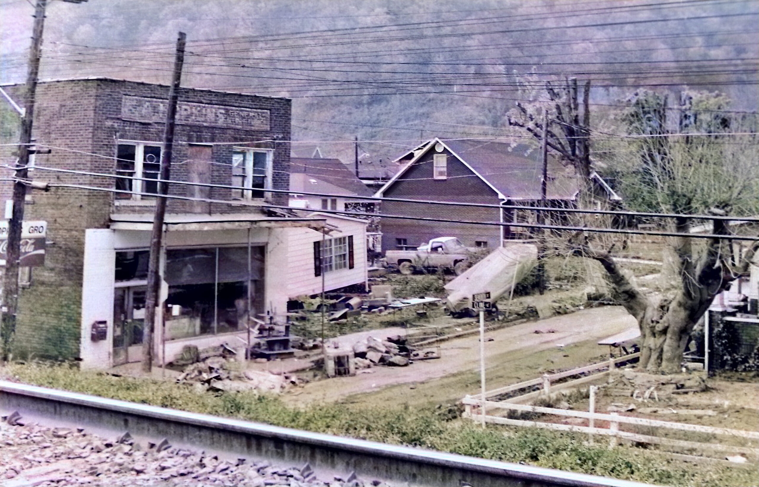
Photo courtesy of Courier-Journal


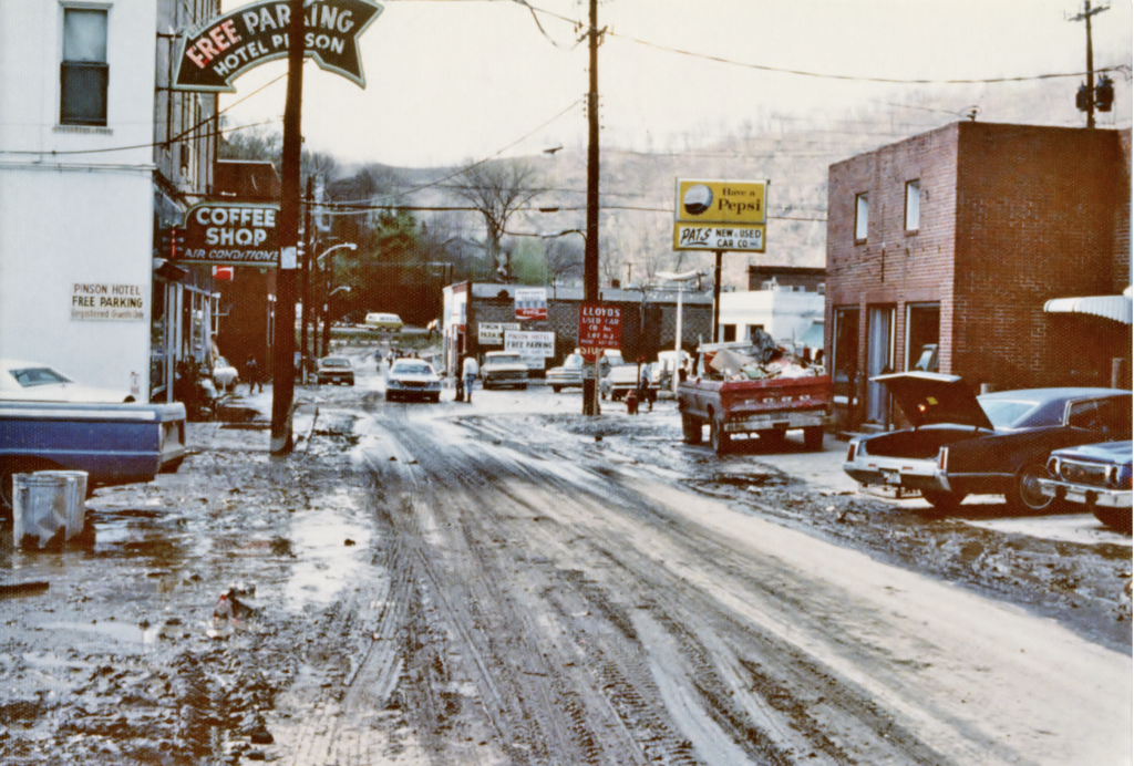
The Pike News , Page 9, April 14, 1977

This disaster van was presented April 3, to the Pike County Chapter, American Red Cross as thew results of the activities. the van, awarded by the National Chapter, ARC, was in use serving coffee and sandwiches to flood victims on April 6, day after flood crest here. more than 10,000 person were served before the weekend on the Pike Courthouse Square by the Red Cross van.


Distribution to flood-families became the Number One priority in the aftermath of the area worst flood in history of Pike County.


April 14, 1977


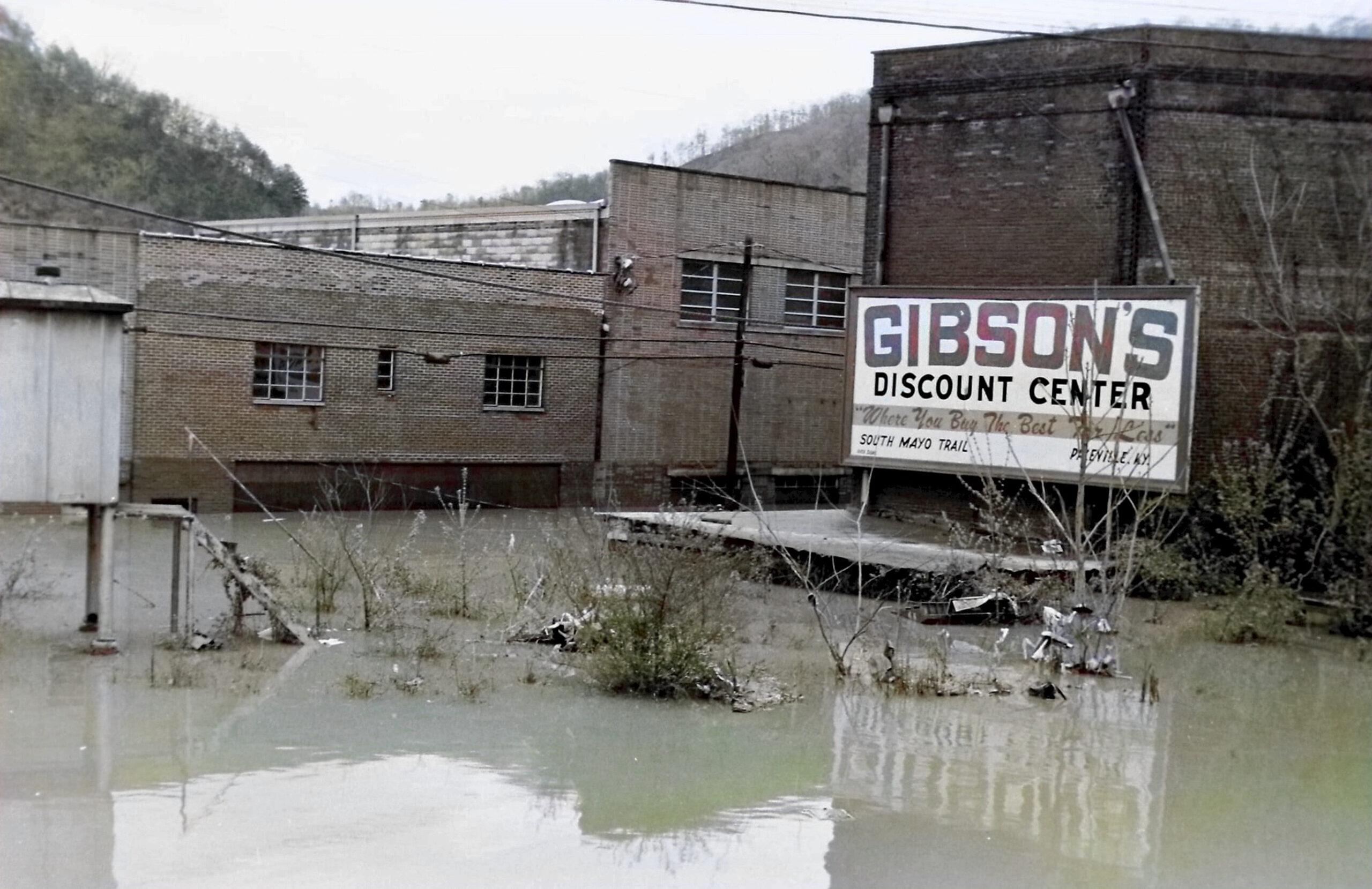
Present day Wright’s Rental and Long John Silver in the back ground.
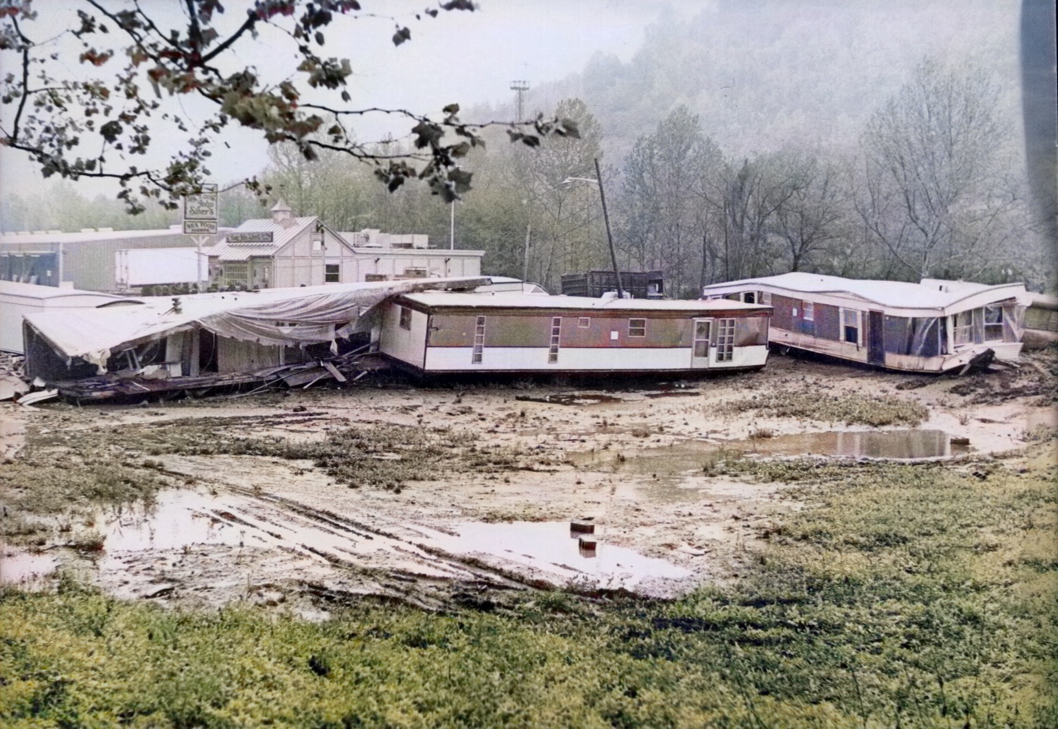
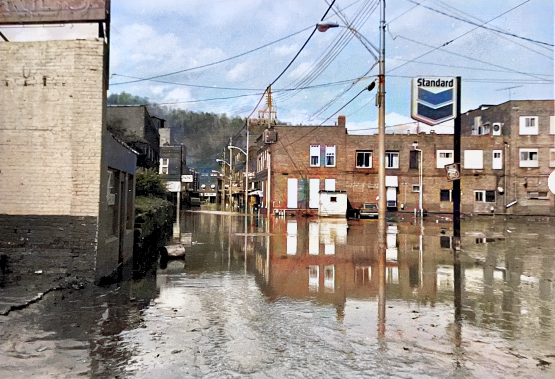
Most of Pike County was severely devastated by the April 1977 Flood


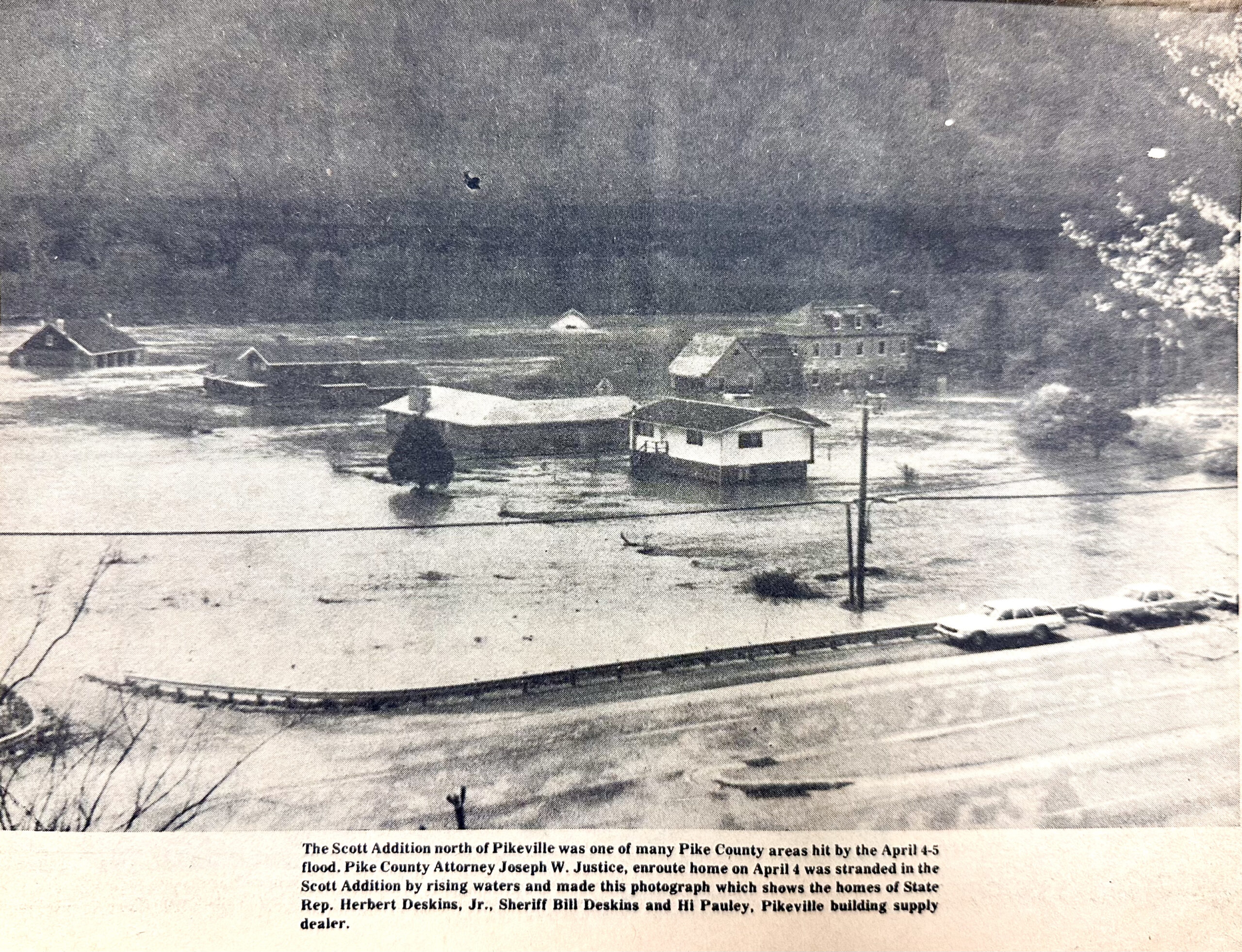
The Scott Addition, north of Pikeville, Pike County News, April 14, 1977


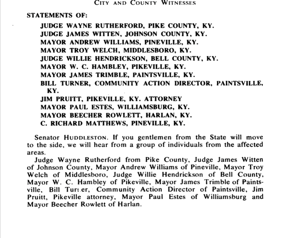

Statement from Pike County Judge Wayne T. Rutherford


Statement from Mayor W.C. Hambley

Statement by Jim Pruitt, ESQ.


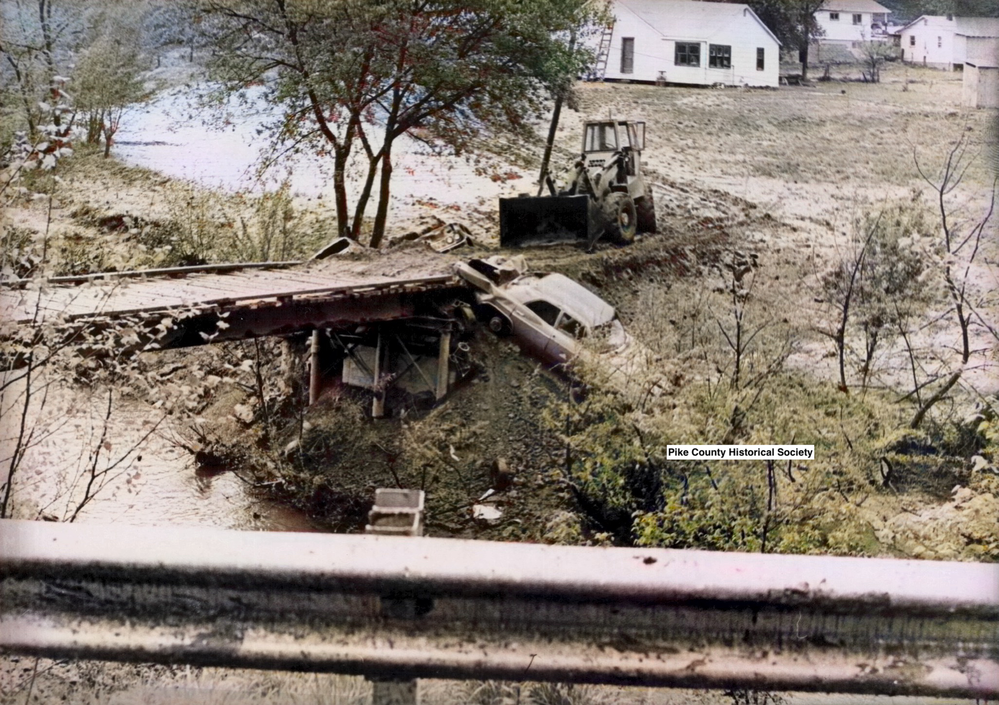
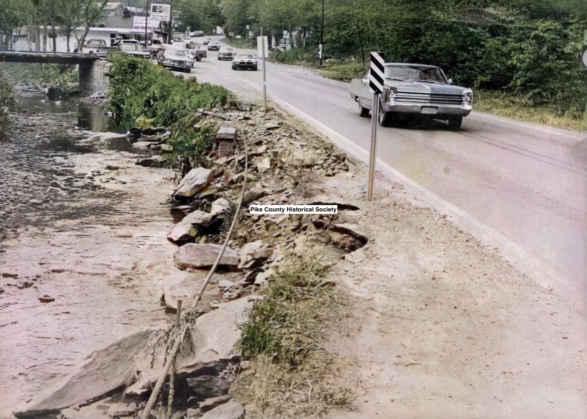
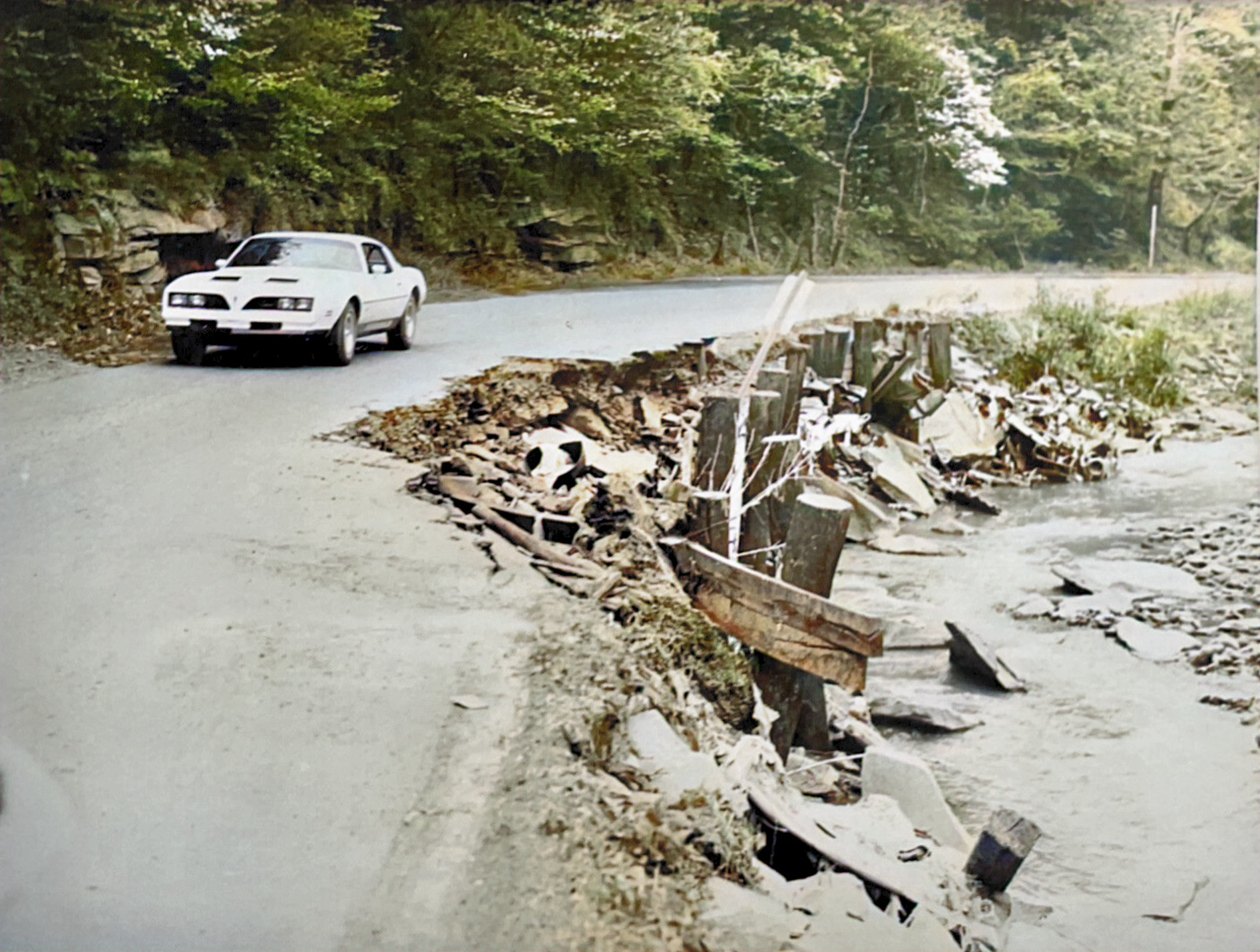
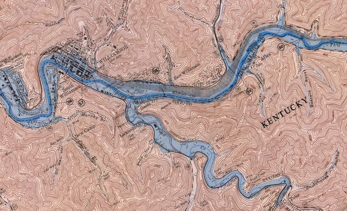
Tug River Flooding, Eastern Side of Pike County , including Pond Creek and Big Creek, April 1977
Subcommittee of the Committee on Appropriations United States Senate 1977
The energy-sensitive Tug Fork Valley area is one in which nearly every human activity is affected by the persistent repetition of flooding. The past two decades, in particular, have witnessed extensively damaging floods, the most recent being the devastating flood of April 1977. Measured in today’s prices, damages from this flood alone amounted to approximately $290 million. Approximately 5,000 homes suffered damage, with approximately 600 of those being totally destroyed. As a result of concerns regarding the Tug Valleys long history of flooding, Congress enacted Section 202 of the Energy and Water Development Appropriations Act of 1981. This legislation authorized the Corps of Engineers to implement such measures as determined necessary and advisable to reduce flood damages from flooding such as occurred in April 1977 •
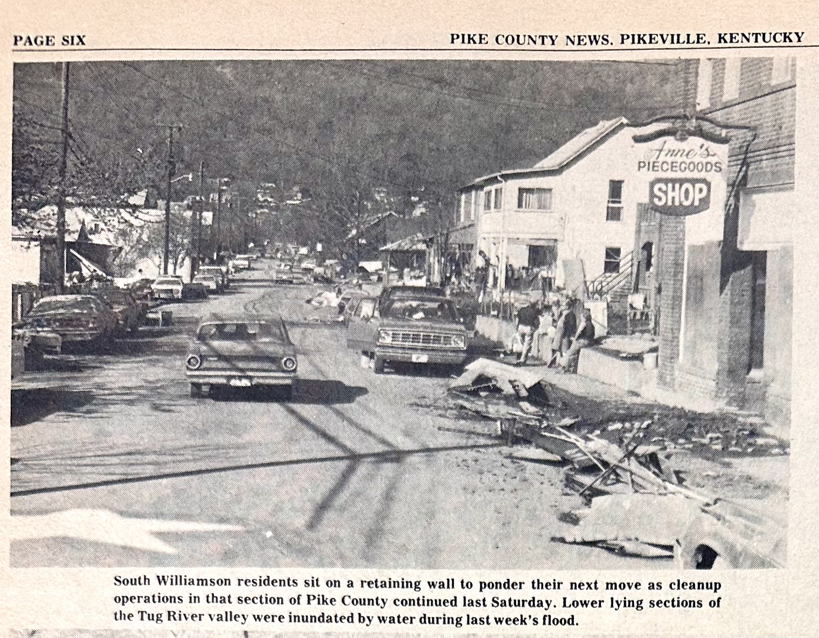
South Williamson, Pike News, April 14,1977
The 1977 Flood Plat Map of South Williamson
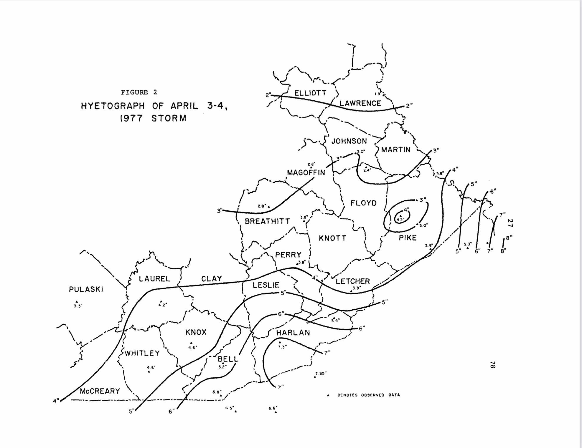
In the time of year when the redbuds and dogwoods are blooming, and the leaves unfolding to canopy this wrinkled landscape, on April 4, 1977, 45 counties in four Appalachian States were struck by flooding. These 45 countleg produced over 162 million tons of coal in 1974, reporting 54.7 percent of production of the four states and 41 percent of coal production in the Appalachian region. The 45 counties contained a population of 1.47 million people and this population is increasing due to expanded coal production.
Of the 45 county disaster area, the Tug Fork Valley suffered the most serious Impacts. Within 30 hours, up to 15 inches of rain were dumped by a series of cloud bursts on frozen ground near the headwaters of Tug Fork. As the deluge moved down the valley flood crests exceeded known records. williamson West Virginia had a flood crest of 52.3 feet, more than 25 feet above flood stage. Flood losses exceeded $100 million In Mingo County, an amount larger than the total personal income earned by Mingo County residents in the entire year of 1973. Total losses In Tug Fork Basin approached $200 million.
The 1977 Flood Plat Map of Buskirk

Tug Fork is located within 7 counties of West Virginia and Kentucky. Coal 1s king In the the Tug Fork Valley. Daily, 16 unit trains laden with coal exit the valley moving north, west, and east. Thirty thousand people reside In the valley and 10,000 live in the flooded area. Over 100 communities or places (none over 4,000 population) are scattered in a linear fashion along the Tug River.
Previous Attempts to Alleviate Flooding
A large regional flood In 1957 brought survey studies by the Corps In the Upper Kentucky, Upper Cumberland, Upper Lilky, Big Sandy and Tug Fork Basins. A reservoir system was authorized and subsequently constructed in the Big Sandy Basin. A major cut off project is under construction to alleviate flooding in Pineville, Kentucky, and to provide a new transportation corridor and to facilitate community renewal. The project Is managed by the Kentucky Department of Highways with Corps of Engineers and other agency participation. In the Tug Fork, local protection by flood walls was installed at Williamson in 1963 and later for the Appalachian Regional Hospital in South Williamson. Reservoir sites were found to entail very heavy costs, difficult implementation, and limited effectiveness in the Tug Fork, and therefore, nor have been constructed. A path-breaking analysis of non-structural flood damage reduction management (through flood proofing by elevation of existing structures in Matewan) was conducted by Huntington in 1970. Meanwhile, the Tug Fork Basin has experienced four major floods since the 1957 event climaxing with the April 1977 flood. That flood topped the flood wall at Williamson by several feet and created the disaster that not only resulted In $200 million In damages but also a $150 million disaster recovery program primarily financed by the Federal government. With the exception of about 600 homes which were completely destroyed by the flood, the disaster recovery operation fundamentally placed people back in the same situation that they were in before the 1977 flood. The Appalachian Regional Commission has moved to Implement a region-wide flood warning and evacuation system, which will serve to reduce the threat of flooding to loss of human life and can partially reduce flood damages.
From the pages of Pikeville College Press