FACT OR FICTION?
TALES OF LOST TREASURE have charmed people through the ages, from Oak Island to the Superstition Mountains. The valleys of the upper Big Sandy and North Fork of the Kentucky River are no exception. There is one story of hidden Appalachian riches that has survived for over 250 years. The legend revolves around the Russell Fork/upper-Elkhorn Creek/Pine Mountain region of Pike and Letcher counties, but has at times been claimed to be hidden within a radius of several hundred miles:
We started on the 25th of June, 1761, from Alexandria, Virginia and came to Leesburg, thence to Winchester, thence to Littles, then to Pittsburgh, thence to the headwaters of Wheeling Creek, thence to the Little Kanawha, thence to the Great Kanawha, thence to the Guyandot, thence to the Great Sandy Creek, thence to the great ridge running in a southwestern direction, and thence to a large river, the name of which was unknown to us, and from there to a large and very rocky creek , and thence to the mines where we remained from the 18th of July to the 26th of October . . .
We left our homes in North Carolina on the 16th of May, 1769, and started for the mines. We went by the way of the door of the Cumberland Mountains and arrived at the mines safe and sound on the 24th day of June, 1769. On that day we stared for home and went by the way of Sandy Creek. At the forks of Sandy we lost two of our horses, stolen by savages, and here we concealed their lading, a great loss to us, but we escaped with our lives, and got home safe on the 1stof December, 1769 . . . On the 1st of September, 1769, we left between twenty-two thousand and thirty thousand in crowns on a large creek running near a south course . . . At the forks of Sandy close by the forks is a small rock-house which has a spring in one end of it, and between it and a small branch we hid a prize under the ground. It was valued at six thousand dollars. We likewise left three thousand buried in the rocks of the rock-house.
So begins the story of the lost silver mines of Jonathan Swift and what some have thought would become Kentucky’s first, and most valuable, natural resource. Historians, including Collins, Kerr, Jillson, and Connelly have more or less accepted it fact. There indeed was a historical Jonathan Swift who lived in Alexandria, Virginia, but he was born in 1764 and would have been an infant during the later years of the legendary Swift’s mining ventures. The same Swift owned land in Kentucky. In 1792 he supposedly bought 10,000 acres on Salt Rock Fork of Big Sandy from George James for a price of five shillings via a Fayette County deed. James had claimed the land in 1785 under a survey whose calls were vague at best and which was junior to other claims. The county of filing should have been Mason rather than Fayette. The price raises the suspicion that both James and Swift knew the grantor did not have a good title. No historian has seriously asserted that this Jonathan Swift and the man who supposedly mined silver in the Kentucky mountains were one and the same. Concrete proof of the existence of Swift’s purported treasure has never been offered.
The purported purpose in coming to the mountains was to mine silver, but there has never been a satisfactory explanation as to how Swift would have learned of the existence of silver ore in eastern Kentucky in 1760. If there had indeed been silver to be mined, how would Swift have known of the ore’s location before Virginians who lived closer and were more attuned to gossip surrounding the Kentucky country? The legend states that Swift was located in Alexandria, Virginia, over 350 miles from the mouth of the Ohio. Any route from Alexandria to the upper Big Sandy would have been a tortuous, dangerous journey. Furthermore, silver in quantities to justify such a journey as Swift supposedly made through hostile territory have never been found in eastern Kentucky and, furthermore, geologists agree that the chances for its existence are extremely remote. Finally, it would make sense that a party laden with silver would face as great, if not greater, danger from White thieves and robbers than Indians. On the 1862 return trip the party was said to have stopped at Cassells Woods, site of modern Castlewood, Virginia. Once their route and purpose became known to people in their stopping points while coming and going, the danger of robbery by those who realized the value of their baggage would seem most likely.
According to the Swift journal, the miners returned to their diggings every year through 1769. Sometimes they would come by way of Fort Pitt, down the Ohio, then up the Big Sandy. At the end of each mining season, they left the mountains either by retracing their river route or crossing through Pound Gap to Castlewood, Virginia, the westward edge of white settlement. Swift kept a journal in which he gave semi-regular accounts of the directions they traveled, landmarks they passed, and distances from point to point. The entries are confusing and open to interpretation. According to one account, Swift’s party built a furnace and produced charcoal in the vicinity of the “Breaks of the Big Sandy,” then traveled southwest along the base of Pine Mountain to their mines,although another journal version says Swift vaguely mentioned that he built a smelter along the headwaters of Sandy River. Daniel Boone passed by that same location in the fall of 1767 and later recalled that he was lost, but made no mention of smelters or other human habitation.
Compounding the uncertainty of Swift’s accounts is the story that he became blind during his later years and could no longer retract his steps to the riches he left behind. Evidently in efforts by others to locate the treasure near the end of Swift’s life, over thirty different copies of the journal are known to exist. No two of the known copies totally agree. Kentucky have the treasure lying in the Red River Gorge, Johnson County, the Elkhorn City area of Pine Mountain, the Breaks of the Mountain, Pineville, Red Bird Fork of Kentucky River, Clear Creek of Cumberland River, as far north as Greenup and Carter counties, as well as Wise, Tazewell, and Dickenson counties in Virginia. Tennessee, North Carolina, West Virginia, and other states also claim the treasure.
The Jonathan Swift story, whether based upon a real person or the product of a creative imagination, offers more than romantic fascination. The story itself, the socioeconomic times in which it occurred, as well as the characters involved in the tale, offers a microcosm of the people and forces which drove the settlement of Kentucky country during the 1780s.
JOHN FILSON left his home, and a debt of fifty pounds, for Kentucky in the fall of 1783. He brought along his surveying skills, a better than average education which allowed him to teach and later author a book, and an ambition to make his fortune buying and selling Kentucky land. He probably arrived in October, and by the end of the year had claimed almost 13,000 acres. In 1784 he literally put Kentucky on the map with the publication of his book, The Discovery, Settlement And Present State of Kentucke, with the accompanying, but separately published, A Map of Kentucky Drawn from Actual Observations. Appendices to The Discovery included The Adventures of Col. Daniel Boon.
One of Filson’s biographers described the book as “a piece of promotional literature.” The author heaped praise upon central Kentucky, but that was the extent of his promotion. It was obvious that Filson had no firsthand information concerning Big Sandy and North Fork of Kentucky rivers. Of the Big Sandy he wrote: “All the land below the Great Kenhawa until we come near the waters of Licking River is broken, hilly, and generally poor; except in some valleys, and on Little and Big Sandy creeks, where there is some first rate land, but mostly second and third rate.” He said of the Kentucky: “The Kentucke river rises with three heads from a mountainous part of the country. Its northern branch interlocks with Cumberland. . .” and later added, “. . . the soil is broken; but even here, we find in valleys, and along streams, a great deal of fruitful land.” Both descriptions were generalizations which undoubtedly came from conversations with others, some of it probably having been retold several times before it reached Filson’s book. A telling example is contained on his map. In the northeastern quadrant, just south of the notation “321 Miles below Fort Pitt,” less than ten miles upstream from the mouth of “Gr. Sandy C.” is noted of Fawlers [sic] Lick accompanied by the symbol for a salt lick, a circle with dots along the outside border. Fowler’s Lick, a salt spring, was by the early 1780s a well-known landmark on the western side of Right Beaver Creek. It was located over 100 miles upstream from the mouth of Big Sandy, a sure sign that Filson knew of its existence only by secondhand information. And that information almost certainly did not come from Boone, who had spent a winter on Middle Creek sixteen years earlier.
As was true of his location of Fowlers Lick, Filson’s topographical depictions of the North Fork of Kentucky and Big Sandy rivers were drawn more from descriptions of others than by on-the-ground surveys. The far eastern portion of the state was not included. Only a few miles of “Gt. Sandy Ck.” upriver from its mouth are shown. The North Fork of the Kentucky River is shown in its entirety, but is not faithfully represented. Soon after publication, Filson sent a complimentary copy to George Washington with a letter requesting that the general endorse his work. The ever rational Washington, who owned tracts of Kentucky land, warned Filson that the prospect of a Kentucky map was interesting, but that it should be based upon actual surveys. Washington never recommended it.
Through the years Filson’s book has become a treasured piece of American history, but during his short life it brought him no financial gain. When Washington refused to publicly support it, thus ending chances for a second edition, Filson reverted to his first venture upon arriving in Kentucky, land speculation. On May 17, 1788, in partnership with Robert Breckinridge, Filson entered a 1,000-acre Virginia treasury warrant claim based upon what most people at the time considered no more than gossip:
Robert Breckinridge and John Filson as Tenants in Common, Enters 1000 acres of land upon the balance of a Treasury Warrant No. 10117 about 60 or 70 miles North Eastwardly from Martin Cabbins in Powells Valley to include a silver mine which was Improved about 17 years ago by a Certain man named Swift at said mine the Said Swift reports he has extracted from the oar a Considerable quantity of Silver some of which he made into Dollars and left at or near the mine, together with the apparatus for making the same, the land to be in a square and the lines to run at the Cardinal points of the Compass aforesaid including the mine in the Centre as near as may be.
Aside from Swift’s purported original journal, of which at last count there were probably three dozen different versions, all claiming to be genuine, that Virginia land entry is the first and only surviving historical mention of Jonathan Swift’s treasure outside of his purported original journal.
It has been suggested that Filson wrote the original Swift journal in order to draw settlers into Kentucky, thus making his property more valuable. One argument against Swift’s authorship of the journal is that its language would have been beyond the ability of a man who by his own admission had spent most of his life at sea. Similarities in language and organization between Filson’s Discovery and Swift’s journal are cited as reasons to suggest a common author. Another suggestion has been that Swift’s journal originally had no connection to a lost treasure, but instead was a Masonic allegory written at the request of early Fayette County Masons. The journal contains several Masonic phrases, but it is unlikely that a young man bent on making his fortune in an isolated village, making two trips back to Pennsylvania during that period, could find time enough to compose such a complicated piece of literature, in addition to writing his Discovery and drawing its accompanying, map during the brief time he was in Kentucky. If Filson indeed composed the journal, a more likely proposition is that it was a partial draft of a fictional work in progress meant to glamorize the Kentucky territory. It is said that he was an admirer of Jonathan Swift, author of Gulliver’s Travels, and that he adopted the name for the narrator of his fictional journal. All the above are feasible possibilities if indeed there was no historical sailor/pirate/silver miner/counterfeiter named John Swift.
In his 1784 Discovery Filson wrote, “Iron ore and lead are found in abundance, but we do not hear of any silver or gold mine as yet discovered,” yet four years later he became a partner in a claim for land on which Swift’s silver mine was supposedly located. Surely some of the same voices which had told him of Fowlers Lick would have known of the Swift legend. To add to the inconsistency, Filson’s last surviving letter was written to his brother, Robert, only ten days after the entry filed under Treasury Warrant 10117. In that letter he spoke of his indebtedness and expressed pride in the good credit he had established in Lexington. He wrote of having entered into a contract with an English physician who recently moved to Lexington. Filson was to be the doctor’s student for two years. His tuition would be twenty pounds, to be paid “in good lands at valuable rates, not exceeding three miles from Lexington,” hardly the type of deal made by a man who had faith in a future financial windfall. He also informed his brother that, once his medical studies were finished, he was to be married. His bride-to-be was obviously a lady of means, as indicated by Filson’s statement that, “. . . I am to be married, which will be greatly to our advantage. Stand it out 2 years my dear brother, you shall have negroes to wait on you.” The June 17 missive to Robert was his final known letter, but not the end of his writing. Less than two weeks after expressing hope for a comfortable future, a June 30 poem, written on Beargrass Creek near Louisville, related his melancholy state of mind following the loss of the lady he called Amanda: “. . . Adieu Amanda who my soul ensnares. . . One leap in yonder gulf shall end my pain. . .”
Speculation has consistently pointed to Filson as author of the Swift journal, but the treasury warrant under which the entry was made has not been closely examined, nor has Robert Breckinridge, his family, or associates been closely examined for possible connections to the Swift legend. The warrant itself is as much a mystery as Swift’s treasure.
A treasury warrant was essentially a negotiable proof of purchase. It was as good as money in the pocket and quite frequently was used in place of currency. During the tumultuous economic times following the Revolutionary War, Virginia’s coinage was so unstable that a treasury warrant to a person looking for prime Kentucky land often appreciated beyond the face value of the coins which had bought it. One who wished to purchase available property would pay a per-acre price to the Virginia Land Office. In return they received a preprinted form with certain pieces of information filled in. Treasury warrants were numbered in sequence. Number 10117 was for 2,119 acres, for which the sum of 3,870 pounds was paid on December 21, 1781. No county was listed on a warrant since it could be used in any county of the owner’s choosing so long as public land was available. A land warrant could be divided and applied in different locations, thus it was possible for a 600-acre warrant to be used to claim 200 acres in Lincoln, Fayette, and Jefferson counties. Warrants, even those held by different owners, could be combined to procure a tract equal to the sum of the parts.
The second step in acquiring public land was to file an entry with the surveyor of the county in which the property was located. The entry would describe the location, acreage, and approximate boundaries of the land to be claimed. Filing the entry in the county of location was not technically necessary, but, aside from being convenient, it assured that the original entry would be protected in case there was a later overlapping, or shingled, entry. If the entry was filed in another county, there was a danger of having a claim denied if it could not be quickly located. An entry was simply a notice of intent. It required little effort and involved nothing more than a minimal, if any, filing fee. The paper filed by Filson and Breckinridge was not proof of ownership and had no legal value beyond giving notice, but modern researchers have gone so far as to claim that Filson received a patent for the property.
The final step to ownership was to have the entry surveyed. Surveyors were in great demand in Kentucky during the early 1780s. Claimants often waited in line to pay high prices to have their boundaries established. Once the survey was put to paper, it was filed with the county clerk. Following a waiting period for exceptions to the claim to arise, the state issued a deed and the land passed from public to private ownership.
The family and friends of Robert Breckinridge, co-tenant of Warrant 10117, reveal some interesting connections to the Swift legend. Land Warrant 10117 was purchased on December 21, 1781. David Robertson, whose last name, along with that of his brother, William, was more commonly written as Robinson in early land records, paid 3,870 pounds sterling for 2,119 acres. The original document, which has long since been lost, was plagued with inconsistencies. David Robinson is listed in Jillson’s works on Kentucky land records, but there is no listing for him owning a 2,119-acre warrant. 10117 is, however, listed on the Kentucky Secretary of State website. Directions to the property encompassed by the Filson-Breckinridge entry originated from Martin’s Cabbins, a resting point along the Wilderness Road in southwestern Russell County. The direction and approximate distances it cited would have put the mine in Bourbon County, yet the claim was filed in Lincoln. No survey outlining the land specified by the entry was ever filed. Where Land Warrant 10117 was ultimately used is unknown. If used at all, it was probably subdivided into smaller tracts.
David Robinson had been a lieutenant in the French and Indian War. He advanced to captain in 1765, to major nine years later, and would eventually hold a colonelcy during the War for Independence. During the spring of 1775 he and his militiamen served as escort for John Floyd through Russell County and into Kentucky. He received a 1,000-acre military warrant for his French and Indian service and later made Kentucky his home, settling near his brother, William.
Before moving to Kentucky, Robinson lived near Shawsville and developed a longstanding relationship with the Breckinridge family. Beginning in February 1770, he and the elder Breckinridge served together as justices of the Botetourt County Court, which held its sessions in Breckinridge’s home. In May 1776 he was granted 1,000 acres on Kentucky River in Fincastle County and four years later added 1,400 acres on Boones Creek in Kentucky County. By the end of 1780 he owned another 3,800 acres in Jefferson County. He died at an unknown date prior to December 14, 1806. John Breckinridge, brother of Filson’s co-tenant, Robert, was one of his executors. How Robinson’s treasury warrant came to be used as the basis of a claim for Swift’s purported silver mine is open to conjecture, but it was most convenient that and old friend of the Breckinridge family had 1,000 acres to spare.
Robert Breckinridge, Filson’s co-tenant, was a third-generation Virginian. His grandfather, Alexander Breckenridge, came to America from Ayreshire, England, by way of Ireland, in 1728. Alexander spent his first few years in Pennsylvania and by 1740 had moved to Virginia, where he died in 1744. Alexander’s second son, Col. Robert Breckindrige, following the death of his first wife, married the daughter of Col. John Preston. Breckinridge served in the Sandy River Expedition of 1756 and was posthumously awarded bounty land for his service on the frontier. He sat on the Augusta County Court in 1751, served an unspecified term as sheriff of Augusta County, and was a member of the first county court of Botetourt in 1770.
The Colonel’s first-born was also named Robert. Young Robert Breckinridge [he and his siblings changed the spelling of the family name from E-N to I-N upon reaching majority age] served with Virginia troops during the Revolutionary War and was captured at Charleston. He was involved in a prisoner exchange and held the rank of lieutenant at the end of the war. Robert Breckinridge probably came to Kentucky in 1783, about the same time John Filson arrived. From the tone of his later statements, unlike those who preceded him, Robert was not overly excited at the prospect of leaving home, but was persuaded to emigrate by prospects of a brighter future in his profession of law than his home county offered. In June 1888, a month after the entry under 10117, he was a member of the Virginia Federal Convention and voted in favor of ratifying the Constitution of the United States. By 1786 he had been granted 2,550 acres in Jefferson County along with a 1,000-acre military grant. He later became Kentucky’s first Speaker of the House. Robert Breckinridge had five brothers and one sister.
The Revolutionary War service of Alexander, the second-born son, paralleled that of Robert, albeit in a different regiment. He was captured in Charleston on the same day as Robert. Alexander came to Jefferson County during the mid-1780s, married the widow of Col. John Floyd, and was elected to a magisterial office. At one point during 1785, Filson filed suit for a debt and asked Alexander to serve paperwork upon the debtor. By 1786 he had been granted 2,100 acres in Jefferson County and had filed entries for over 17,500 more. Of those entries, slightly over 12,000 acres were eventually surveyed.
William Breckinridge was the third son of the family. He moved to Fayette County about the same time as Robert. In May 1784 he entered a claim for 24,688 acres along the Ohio River in Jefferson County, but the entry was later withdrawn.
The fourth son of Col. John Breckinridge was destined to become the most famous sibling. John Breckinridge was educated at William and Mary and elected to the Virginia assembly. Before coming to Kentucky, he speculated in Kentucky real estate from a distance. In January 1785 Breckinridge received a 1,000-acre grant for his war service. Five months later he purchased 5,662 Fayette County acres. In 1785 he filed entries for 13,600 acres in Fayette, but withdrew on 7,800 of those. He came alone to Kentucky in 1790, bought property for a home, and brought his family 1793. John Breckinridge later developed an interest in eastern Kentucky land, particularly on Levisa Fork tributaries, where he was granted 11,182 acres in 1796. He served as Kentucky Attorney General from 1795 to 1797 and was elected to the United States Senate from 1801 to 1805. In 1805 he became Attorney General of the United States under President Jefferson and served until he died, probably of tuberculosis, in December 1806. Following his death, his estate was “terribly complicated with claims and demands, was a great burden and would be in litigation of one sort or another for the next forty years.”
James Breckinridge, the fifth brother, following the death of his father, was raised by an uncle, William Preston. He became a lawyer in Fincastle and held several elected and appointed positions. Although he never lived in central Kentucky, and probably never visited for any length of time, James filed entries for over 26,000 acres of Jefferson County land in 1785. Over 6,000 of those were soon withdrawn.
Lettice Breckinridge was the stepmother of Robert and Alex and the natural mother of the other children. She married Col. John Breckinridge after the death of his first wife. Late in life she moved to Fayette County and probably lived with John, her natural son. She died there in 1798. Before she moved to Kentucky, she, like her son, James, speculated in Kentucky land. Between 1780 and 1784 she entered claims for over 8,100 acres in Jefferson County, of which only 500 acres were surveyed. The contrast between the total of the entries, or intentions to claim, and the actual land surveyed on behalf of Lettice Breckinridge and her children tells a story which was all too common for that period of Kentucky history.
Lettice and her children entered claims for approximately 90,000 acres between 1780 and 1786. Over 58,000 acres, or some sixty-five percent, of those entries were withdrawn and never surveyed. Those numbers bespeak a condition early Kentuckians described as being land poor: the Breckinridges had entered claims for thousands of acres but, depending on the continued heady success of the Kentucky land fervor, they were left with little hard cash. The reason behind some of the withdrawals lay with the success of their speculation. Buyers with cash in hand or warrants for more desirable properties purchased or traded for Breckinridge warrants or parts thereof. The downside of the picture is that, while possessing claims for thousands of acres, they would probably not have been financially able to pay the tax burden levied upon those properties. The Breckinridge sons’ grandfather was an Irish immigrant who went to Pennsylvania before settling in Virginia. Col. Robert Breckinridge had spent a good part of his adult life involved with militia affairs. When he died in 1773, his estate was worth 3,000 pounds. His will provided that certain tracts of his land be sold and the funds set aside on interest to provide young John “a learned education,” but when the money was gone the widow and seven children looked to relatives for support. Those same kinfolk help put John through William and Mary. The family had achieved respect through its public service, but the Breckinridges had not enjoyed financial success. The land they had claimed through their entries was ready to consume them. The same was true of Filson. He had been in debt when he left his eastern home and his estate was indebted following his death. Of the thousands of acres for which he had filed entries, he had surveyed only 4,922, or slightly over one-third. He and the Breckinridges were mired in the same predicament.
Filson was acquainted with Alexander and Robert Breckinridge, as well as Martin’s Cabbins, before the May 1788 entry under Warrant 10117. There is no evidence that Filson ever met John, James, or Lettice Breckinridge, but facts suggest the possibility. During the late summer of 1786 Filson set out from Louisville for Pennsylvania. Instead of taking what most considered the more comfortable and safer route up the Ohio River to Pittsburgh and then across country to Chester County, he followed the Wilderness Road out of Kentucky. On September 9 he was in Danville, getting a late start after losing his horse. A later notation in his journal was the twenty-mile distance from Cumberland Gap to “Martin’s Cabbins,” better known as Martin’s Station. Filson’s path to and from Pennsylvania took him by Martin’s Station and through southwest Virginia. Probably not coincidentally, Filson followed what he had noted on his map as “The Road from the Old Settlements in Virginia to Kentucky thro’ the Great Wilderness” because it passed through the Breckinridges’ home town of Fincastle. A plot to intrigue explorers, fortune seekers, and land speculators with the rumor of silver in the mountains east of the Bluegrass, while at the same time giving some needed financial relief to the cash-strapped Breckinridges, could well have been hatched in Fincastle during the late summer or early fall of 1786. This date fits neatly with Steely’s estimate that the Swift journal first appeared in public about 1785.
Population growth ensured profits for real estate speculators. Either of the Breckinridge brothers who speculated in Kentucky land, and/or their mother, would have had motive to commission the writing of the Swift journal. Filson would have been sorely tempted by an offer. He had written to a creditor while at Danville: “I have but little Money, but my will is good, therefore you will excuse me.” The obvious one to put his name on Warrant 10117 beside Filson’s would have been Robert, who was in good shape financially with unencumbered property and he had no unfulfilled entries of record. John Breckinridge, however, was the man who could have supplied the details to make it the story insinuated by 10117 believable.
On June 25, 1780, John Breckinridge commanded a company of Virginia militia guarding the lead mines at Fort Chiswell. In a letter of that date to Col. William Preston, his uncle and commanding officer, he related news of some Tory activity in the area of New River and the threat of further trouble. He continued: “There was also a Captain of the Militia taken by them [Tories] by the name of Swift who brings the same accounts, adding that there was a good many British officers among them but could not ascertain the number.” Swift was a fitting figure upon which to base the journal’s narrator and main character, but Flower would never do. That name would have been ridiculed by the public. A more appropriate appellation for the era was Jonathan, or John, as in John Breckinridge or John Filson or the already-popular Jonathan Swift. Whoever wrote the Swift journal was probably familiar with the Pownall Evans map, originally issued in 1755 then corrected and reprinted in 1776. On the later version, north of the headwaters of the Holston River and just south of the source of the Bluestone River is depicted along a mountain pass “A Remarkable Rock.” In the Swift journal, one passage states: “Between the small lick and the furnace is a remarkable rock. . .” That the Swift journal and the most popular map of the day would use the same adjective to describe points of reference is, well, remarkable. Published maps of the time were of large format and not carried by explorers and hunters, but were used primarily by land speculators, government entities, and universities such as William and Mary where John Breckinridge was educated.
More than one facet of Flower Swift’s life seems to have been custom-made to fit the John Swift silver story. His grandfather, the son of a London merchant with interests in Jamaica, died at sea when returning from England after collecting an inheritance. It is said that he was very suspicious of outsiders, probably with good reason. The tradition among his wife’s family, the Bedsauls, is that Swift and his brother-in-law were blacksmiths by day, but by night they minted counterfeit silver coins. One descendant/family researcher has stated: “He and his circle were very likely involved in counterfeiting various silver coins during this period . . .” Dr. Clyde Bedsaul of Galax, Virginia, reminisced in 1956: “My own ancestors emigrated from Old Chestnut Creek. One of my great-grandfathers at one time owned much land upon which East Galax now stands. Then there was the exciting story of the two bell-making blacksmiths who operated a shop towards Wolf Glade – out the Hillsville road. These men had a secret mine . . . They carried their ore to their shop in buckskin sacks. Their days were spent in making bells, their nights in smelting . . . Government agents finally grew suspicious and when the counterfeiters were about to get cornered they buried their ‘money’ moulds and knowledge of the location of the secret deposit of silver with them.” Dr. Bedsaul was undoubtedly writing about Flower Swift and his Bedsaul brother-in-law. The years between 1770 and 1779 in the life of Flower Swift would have been a mystery to the public. Like the Swift of the Journal, Flower Swift was a supporter of American independence. Like the legendary Swift, he was imprisoned, albeit briefly, due to his support of American independence.

The Pownall Evans map with the notation “Remarkable Rock,” the same description used in the Swift journal (loc.gov). Coincidence?
By the mid-1780s the Kentucky land bubble was no longer expanding. The fortunes made in Bluegrass property existed mainly in the form of promissory notes and IOUs. Little cash changed hands when deeds were made. In some cases speculators who came late to the game were holding land for which they had paid more than it was worth. A fresh influx of cash-laden settlers was desperately needed, but there were deadly obstacles.
Settlers came to central Kentucky by both the Ohio River and the Wilderness Road, but Indian attacks were frequent and tales of atrocities and mutilations of travelers prevented many from attempting the overland trip. The stories spread like wildfire at the time Fayette and Jefferson land was being purchased by speculators who intended to get rich.
By 1785, a few thousand newcomers had arrived via flatboat, or Kentucky Boat as it was commonly known, down the Ohio River from Fort Pitt and points upriver. For every brave soul that made the trip, there were scores who valued their lives over the chance to better their finances. A June 1, 1785, letter copied to America’s newly-appointed Secretary of War, Gen. Henry Knox, summarized conditions along the river: “The Cherokees are hostile, and have killed and scalped seven people near the mouth of the Scioto . . . Speeches have been continually sending by the British, from Detroit to the Indians, since the treaty, and I have good intelligence that several traders have been amongst them, using all means to make them entertain a bad opinion of the Americans.” John Filson appreciated the native threat along the Ohio. Shortly before his death, in a May 27 letter to his brother he warned: “The Indians are very troublesome.” He went on to tell of a father and son who had recently been killed and ended with, “We are all warriors here, when the troubles will end I know not.”
The years 1784 through 1786 were even more perilous for Kentucky-bound travelers coming through Cumberland Gap as well as settlers on the nearby Powell and Holston rivers. In April 1784 there were unspecified depredations in Powell Valley and along the Kentucky Road. In addition, a boy was killed and a girl taken prisoner. In September a band of Shawnee came up the Big Sandy River and onto the Clinch. They divided into parties to steal horses and generally create trouble for the settlers. One group came to the cabin of Andrew Davidson at the site of modern Tazewell, Virginia, and found only Mrs. Davidson and five children at home. Mrs. Davidson and the children were started on a march which eventually took them across the Ohio River. When they reached Ohio, the female Davidson children were tied and shot before their mother’s eyes. The boy was given to an old squaw for a slave and later drowned. Nothing is known of the other two children. Mrs. Davidson was sold to a Frenchman and taken to Canada. She returned home several years later. Around the same time as the Davidson tragedy, a southwest Virginian named William Whitley was killed. The braves mutilated his body by tearing out his bowels, which were stretched on bushes. His heart and liver were hung in different places. In March 1785, a party came to the John Wallen home, about fifteen miles from Abingdon, where they shot and killed a Cox lady and killed and scalped Mrs. Wallen. A week later, three warriors captured fifteen Whites some twenty miles from Abingdon. During the winter of that year, a man, woman, and two children were killed on the Kentucky Road by a party of Cherokee led by a chief named Rattlesnake. During the same year, three men were killed near Cumberland Gap by the Creeks. On Powell River, a boy was scalped and an arrow left in his breast. In June 1785, some Cherokees raided the Archibald Scott cabin on Wallens Creek in Lee County, close to the Kentucky Road. The warriors scalped Scott and his five children, then took Mrs. Scott captive and carried her to northern Kentucky on their way to Ohio. Ms. Scott escaped and eventually made her way back by way of the North Fork of the Kentucky River, through Pound Gap, to the fort at Castlewood. Next door to the Scott cabin there was an eleven-year-old girl and her young brother. The war party fired through the door and killed the boy. His sister evaded capture, then laid out her brother’s body for burial and sat in wake until some men arrived to bury it. In July 1786 some Shawnee attacked the Abbs Valley home of Capt. James Moore. They killed Moore, two of his children, and a sick man in bed in the loft of the cabin. Many thinking of going to Kentucky undoubtedly heard the story of the fate suffered by the captain’s wife: “Mrs. Moore had her body stuck full of lightwood splinters which were fired, and she was thus tortured three days before she died.”
Stories of these scalpings, tortures, killings, and captivities, plus scores of other undocumented instances, were told and retold, exaggerated with each new reiteration. With each successive tale, investors in central Kentucky land could see future profits melt away. The paths to the gaps in Cumberland Mountain into Big Sandy and North Fork of the Kentucky drainage lay squarely within the area where many of these depredations occurred. By making public a journal which gave vague directions to buried treasure in the eastern Mountains, fortune seekers would flood into the valleys of Tug, Levisa, Russell, and North Fork to find the silver. Of course, no precious metal would be found, but the White treasure hunters would eliminate the Indian threat in the mountains. The anticipation was that a flood of eager newcomers would then rush through the gaps, down the valleys, and into central Kentucky, which leads to the most important aspect of 10117.
There were two Wilderness Road stations in Lincoln County. The first was Crab Orchard, the second Stanford, the county seat. Filing an entry for an Appalachian silver mine in Fayette or Jefferson county would have raised eyebrows, but little excitement. By filing in Lincoln, however, as soon as news of what 10117 contained left the surveyor’s lips, the news spread quickly back through Cumberland Gap and along the Clinch, Powell, and Holston river watersheds.
Chances are that John Swift’s journal and its tale of treasure in the mountains was nothing more than a self-serving concoction dreamed up by the Breckinridges, eager to be relieved of some of their Kentucky holdings, and written by John Filson. Several things would have come together: a friend of the Breckinridges, David Robinson, who had an available land warrant; another friend, Filson, who possessed the surveying vocabulary and writing skills to make the Swift journal believable; John Breckinridge, who had commanded a militiaman named Swift who was accused of being a counterfeiter working in silver; Robert Breckinridge, who lent his well-known Kentucky reputation to the entry; and, finally, the pressure to pay taxes on thousands of acres of land which in some cases the owners had never seen.
Filson’s actions following the filing of Entry 10117 show that he did not personally believe the story of lost silver. In his final surviving letter, he told of having taken up the study of medicine and having entered into a two-year contract with a local doctor to learn the trade. As usual, he dwelled briefly upon his beleaguered finances, told his brother to pay a creditor in Chester County, but held out hope for better days when he revealed that he was to be married to a lady of wealth once his medical internship was complete. Obviously excited at the prospect of marrying into money, Filson encouraged his brother: “Stand it out 2 years my dear brother, you shall have negroes to wait of you [sic].”
Filson’s bad luck in finances proved true with his romance. A few weeks later, while on Beargrass Creek near Louisville, he composed a poem to an unknown lady named Amanda. His verse ended by expressing a contemplation of suicide:
One leap in yonder gulf shall ease my pain,
Then to Elysium fields I’ll wing my way,
Through dreary wastes to reach perpetual day,
There with happy souls I’ll careless rove
And in their realms forget the pains of love.
Filson’s nature was too flighty to be distracted for very long by lost love and tales of treasure. Instead of heading up the Ohio River to the eastern Kentucky mountains to develop the mine he and Robert Breckinridge ostensibly owned, in August he entered into an agreement with two partners to develop a town “opposite the mouth of the Licking River, on the North West side of [the] Ohio. . .” By September he and his partners were on the future site of Cincinnati, which Filson named Losantiville: “L for Licking River; os, Latin for mouth; anti, Greek for opposite; and ville, French for city.” Toward the end of the month, Filson joined others who went off to explore the territory north of the settlement he had recently surveyed. On October 1 the words he had written to dissuade his brother from coming to Kentucky proved prophetic when: “The party with whom John Filson was in company was attacked by the Indians . . . The party had dismounted from their horses and were gathering plums where the Indians made the attack. Two guns were fired by the Indians when each one made for their horses. Filson was one of the hindmost of the party or nearest the Indians and he was never heard from afterwards.”
Speculation has raged since then as to the alleged ransacking of Filson’s trunk following his death. It has been proposed that the Swift journal was part of its contents and that it made its way into the public domain shortly afterward. The most likely reason, if it was indeed plundered, was to search for his copy of the contract for the development of Losantiville. Typical of his financial dealings since he came to Kentucky, Filson had made no payment toward his share of the obligation.
Filson’s beckoning newcomers to Kentucky with tantalizing dreams of finding lost treasure was not the only mid-1780s inducement by men with ulterior motives.
GILBERT IMLAY served in the Additional Continental Regiment under Colonel David Forman during the American Revolution. At the end of the war, like thousands of other veterans, Imlay found himself with adult responsibility but little opportunity to improve his station in life. So, like John Filson and Robert Breckinridge, he came to the land west of the Appalachians. Like Filson and Breckinridge, Imlay arrived in 1783. Imlay and Filson were at first glance cut from the same mold: both were well educated, with Imlay probably the better writer; both were keenly aware of the importance of recording the history of the westward movement into Kentucky; both were cartographers who published maps of the western land; both were capable surveyors with Imlay being named deputy surveyor of Jefferson County; and both were determined to make fortunes by playing the land speculation game which was then raging.
Imlay lost no time in acquiring land. He was what would have been called a land-jobber, one whose income depended upon quickly finding and having land for sale to eager buyers. It has been documented that during his nearly three-year tenure in Kentucky Imlay transferred some 200,000 acres with one estimate as high as half a million, but had claimed, surveyed, and received title in his name for only 20,000 acres in Fayette and Jefferson counties. Imlay soon learned that the land speculation game was a cutthroat affair, no place for the inexperienced to compete against Philadelphia and Williamsburg financiers. It took a little over two years for Imlay to find himself hopelessly in debt. In late 1785 he surreptitiously left Kentucky one step ahead of summonses and court proceedings. In 1786 he sold over 15,000 acres in one transaction. Instead of the usual promissory notes and personal bonds, this sale was significant in that the consideration was paper money and silver dollars.
In contrast to John Filson, who continually fretted over his debts and sought to satisfy his debtors, Imlay was a true con artist. Aside from the fact he was in out of his league in financial matters, Imlay had other pressing reasons to flee Kentucky: he had entered into a contract with John May and Samuel Beall, two high-profile operators in Kentucky real estate, to sell 100,000 acres of land but had failed to meet his obligations; in another deal, he had “swindled veteran woodsman Daniel Boone out of ten thousand acres of prime Kentucky land by selling it . . . before paying for it.” Over fifty years later, the sting of Imlay’s dishonesty lingered with Boone’s son, Nathan: “At an early date he [Daniel Boone] sold a splendid tract of 1,000 acres, lying between the head of Elkhorn and Boone’s Station, to Gilbert Imlay and took his bond . . . Imlay sold this tract to others, then went to England and died there, and Father lost the land, as he was never paid.”
Imlay gathered his cash from the sale of his Kentucky tracts, as well as his misbegotten funds, moved back east, and invested in one of the most atrocious commercial schemes in American history. The basics of the operation were that ships would leave eastern American ports bound for the West Indies. In the West Indies the ships were loaded with rum which went to Africa where it was traded for slaves. The slaves were then brought to the West Indies where they were traded for more rum, whereupon the cycle would begin anew with handsome profits for the owners of the ship. This three-port sequence was called the triangular trade.
The bad luck Imlay had suffered in Kentucky carried over to this new venture. He purchased a one-half interest in a slave ship, paid for with cash and a personal note, which had been on the Gold Coast for some time when the title passed. The captain of Imlay’s ship, the Industry, at one time wrote that he had “. . .bought thirty slaves ‘of the Blacks’ for 30 gallons of rum a head. . .” The Industry eventually headed to the Indies with ninety-six slaves, but arrived in American with only seventy-two.
Imlay soon disappeared, as did all potential profits. One of the two remaining investors lamented: “Having sold half of the Brig and one quarter of her Cargo to Imlay and he having absconded, I lost the whol[e] of that Property. . .” His disappearance was only temporary.
Imlay surfaced a few years later, a new man. He had literally reinvented himself with a new background and a refurbished persona. Instead of the man who had barely escaped arrest in Kentucky, he described himself as one who had been a “Commissioner for laying out Land in the Back Settlements,” who, instead of carrying the reputation of a swindler, carried the title of Captain. Imlay’s new facade made him the darling of progressives in London. In the interim between 1786 America and 1792 England he established a new profession. Rather than a former slave trader with no regard for human rights, as the author of one of the most popular books of the day and an expert on the Kentucky territory he mingled with the social and political reformers who thrived in the aftermath of the French Revolution In May 1792, when Imlay’s Topographical Description of the Western Territory of North America was published, the book was immediately adopted by reformists.
Topographical Description was formatted as a series of letters which, like Filson’s history, was a promotion of the land west of the Appalachians. It was geared toward persuading western Europeans and citizens of the new American country to relocate to Kentucky. Both the book and Imlay were well accepted in America until the real purpose of his Kentucky propaganda was made public; he was a close associate of Gen. James Wilkinson
Wilkinson, commander of the American army, was involved in a conspiracy with Aaron Burr to separate Kentucky and Tennessee from the United States. The plan was to have both states become part of the Spanish territory. Wilkinson eventually had second thoughts and reported Burr’s conspiracy. Burr was tried for treason, but was not convicted. The consensus of the time was that Imlay’s Topographical Description was intended in some small part to aid the settlement of Kentucky with those who would support an alliance with Spain.
Mingling within the literary circles of London, Imlay became embroiled in a relationship with Mary Wollstonecraft. It was a mating of conflicting ideologies: Imlay, the former slave trader, confidence man, swindler, and fugitive from Kentucky justice; Wollstonecraft, the loudest, and often the only, voice in Europe proclaiming equality for women. The romance was doomed from the beginning, but there were two lasting collaborations between the two.
First was a novel, The Emigrants. It, like Topographical Description, treated the central Kentucky region as the prime location to begin a new nation free of the moral, ethical, and political shortcomings of the established colonies. Second was an illegitimate daughter, Fannie. Imlay proved the leopard could not forever hide its spots by ignoring the child and returning to London without Wollstonecraft. The affair ended when she followed and found him living with another woman.
Imlay’s book, like Filson’s, had little to offer regarding the Upper Levisa and North forks. That Imlay freely used Filson’s work is not disputed, but, when it came to the mountains which separated the eastern seaboard from Kentucky, he put a new spin on the subject. Rather than being an impediment to travel and settlement, Imlay portrayed the Allegheny and Cumberland ranges as a moral demarcation which separated the corruption of the eastern seaboard, with its greed, slavery, and class stratification, from the purity of the western lands. Imlay did take Warrant 10117 a step further, not by name, but by implication. He never broached the subject of silver in the mountains of eastern Kentucky in Topographical Description, but hinted at its existence by stating he could not confirm reports of black lead mines on the Kentucky River headwaters. If he could not confirm such reports, readers at least assumed he had heard of them. Lead, of course, was thought to be an ore which produced silver.
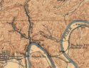
If the book’s intimation of silver bearing ore in the Appalachians did not arouse interest, the map (Above) which followed Topographical Description in February 1793 certainly did. Entitled A Map of the State of Kentucky, it suggested that Imlay had at least heard the rumors arising from the entry filed under Warrant 10117. West of Harman’s Station and the Great Salt Spring [modern David, Kentucky] is the notation Reputed Silver Mines. The script covers thirty miles in scale and runs south-southeasterly, ending near the point where Russell Fork enters Levisa. The beginning would today lie on Licking River drainage, but is portrayed as starting on the headwaters of the North Fork. Taking the reference points which were established at the time, Harman’s Station, the salt spring at David, Balclutha, and Vancouver’s Fort [both established in 1789 near modern Louisa], the location west of the salt spring on Licking would be more likely than near the misplaced headwaters of the North Fork.
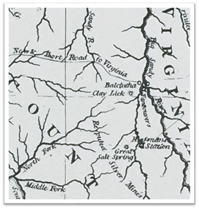
Imlay map section showing “Reputed Silver Mines” (Verhoeff)
Imlay had left Kentucky over seven years before his map was published, two and one-half years after the entry under 10117, and some six and one-half years prior to the publication of Topographical Description. Despite his absence, his knowledge of the rumors and gossip surrounding the fabulous natural resource wealth said to lie in the eastern Kentucky mountains was current. The source of his knowledge is unknown.
INTEREST IN THE SWIFT LEGEND has had its ups and down through the years. On November 32, 1816, Cader Powell, a Pike Countian, filed an entry for fifty acres in Russell County, Virginia. The entry cited the land as lying “. . .on a small branch of the Pound Fork of Sandy River, beginning below a deer lick on the line of an old lick on the north side of the branch to include a place of silver ore where it was supposed Swift and company worked.” As was the case with Entry 10117, there was no further known action taken on Powell’s entry.
In February 1873, the Greenup Independent of Greenup, Kentucky, carried a lengthy summary of the tale and added what was then new information when it printed:
“When Swift was driven from the silver mines in Kentucky by the approach of hostile Indians, he returned to his home in North Carolina . . . he was arrested as a counterfeiter. In those days . . . the only test of the circulating money was the purity of the metal. Upon the trial of the case against Swift, it was proven that the coins in his possession were pure silver, and the charges were dismissed.
“The ancient tools and instruments used for coining money, which fell from a cliff in Carter County were seen and examined by men now living . . . One of the first settlers of the county found near his cabin a quantity of cinder of such unusual color and weight as to induce him to have it tested . . . the result was a considerable amount of pure silver . . .
“At an early day, silver money was in circulation in the settlements of what is now West Virginia, said to have been made by Swift.
“A bar of pure silver was found many years ago near a small mill in Carter County . . . And, within the past few days, a piece of ore which has every appearance of silver ore, and a small quantity of metal which is said to be silver, was shown by a gentleman of undoubted veracity, who testifies that he got the ore in the mountains of Kentucky, and with his own hands smelted the metal from ore obtained in these mountains.”
The Greenup Independent statement that the Swift of legend was from North Carolina is interesting. One of the first published versions of the journal in 1927 has Swift narrating his party’s comings and goings, always back and forth from the mines to Alexandria, Virginia, and vice versa, by various routes. Then, in preparation for the inbound 1769 trip, the narration abruptly and inexplicably switches to: “We left our homes in North Carolina on the 16th day of May, 1769, and started for the mines.” Was this a momentary loss of concentration, unknown information the narrator neglected to mention, or was a missing portion of the original responsible for the sudden change in location? More likely, it was a lapse in focus which referred to the real central character of the story, Flower Swift.
Flower Swift lived in the Piedmont region of North Carolina until 1771. His family was associated with the Regulators, those who revolted against corruption among local office holders in what is today known as the War of the Regulation. Swift and his family were identified with the Regulators and moved north into the Chestnut Creek section of Virginia after their May 16 defeat in the Battle of Alamance. Their new home was the same area south of modern Galax that Dr. Clyde Bedsaul wrote of in 1956 as being the home of two counterfeiters. The time of the relocation to Virginia begins the ten-year gap in Flower Swift’s known history.
That there are no silver veins in the eastern Kentucky mountains does not mean those who told of their existence were guilty of deliberate misstatements; they could have simply been mistaken. Verhoeff offers a logical explanation for the confusion:
“Some of the ores contain considerable quantities of hydrated silicate of alumina which has been mistaken for silver . . . The remains of numerous furnaces in the region are probably works erected at an early day by parties in search of Swift’s Silver Mine which tradition has located in every mountain county.”
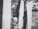
The possible existence of Swift’s treasure received renewed publicity from the 1992 exploration of a cave atop Pine Mountain, between Grassy and Jesse gaps. An anonymous explorer was said to have found a hoard of English and Spanish coins, all of which predated 1760. Following the outline of the original Swift legend, the cave explorer was forced to leave behind three kegs of coins, several silver ingots, as well as silver statuary, when the passageway into the cave flooded. This find, if indeed true, would be some of the most compelling evidence pointing to the authenticity of the Swift treasure. On the other hand, none of the coins have been publicly displayed, tested, or verified for authenticity.
As with all tales of free riches for the finding, doubt has existed as to the authenticity of the Swift story since it became public. One legend has it that Chief Cornstalk personally aided Swift in his travels and in locating his mines, but this has been dismissed as a colorful bit of fancy with no proof. Other legends and folklore figures have been associated with the elusive Swift mines. One tale asserts that the renegade Cherokee chief Bob Benge worked a silver mine in the gorge of the Breaks, but Benge lived much later than the 1760s. Some say Sol Mullins, a southwest Virginia counterfeiter who has regionally become as legendary as Swift, obtained his metal from the old Benge mine.
The Swift journal states that he had Shawnee in his party, but at times they were attacked by hostiles. The years between 1760 and 1769 when Swift was supposedly crossing the mountains were times of occasional Indian hostility. Pontiac’s Rebellion saw massacres along the upper Ohio valley. King George’s 1763 edict prohibited settlements in the country west of Cumberland Mountain and forbade property dealings with natives. Swift was neither settler nor land agent, but the fact that the decree was issued in order to calm hostilities raises the question of how he was able to consistently avoid their ill humor. The Swift journal tells of skirmishes with natives and losing horses to them, but historians question how Swift and his men, leading a slow moving pack train laden with treasure and supplies, could have consistently avoided capture, torture, and/or death at the hands of determined pursuers.
In late 1767, Daniel Boone came down Russell Fork and passed by the very spot Swift was alleged to have produced charcoal, but reported nothing in the way of ovens or silver works. He then followed Levisa Fork to what was later called Young’s Salt Works, ten miles or so across the river from modern Prestonsburg. He and his party wintered there and lived to tell about it, but Swift’s claim of making a round trip annually over a decade strains credulity. Judge Richard Apperson of Mount Sterling at one time purportedly owned the original Swift journal. Apperson rode the court circuit in eastern Kentucky and often was on the bench in Pikeville, but there is no mention of the judge ever searching for the lost silver mine. Dr. Thomas D. Clark, Kentucky’s preeminent historian, evidently researched the early land records sufficiently to find there was a Jonathan Swift who owned Kentucky land, but failed to match his birth with the dates of Swift’s land acquisitions, journal dates, and Warrant 10117. Nevertheless, Clark concluded: “Historically John Swift may have been a liar extraordinary, but his legend has been a part of Kentucky folklore since 1770.”
There is no way to calculate, or even approximate, the number lured to Kentucky by Filson’s Discovery and its accompanying map. The same is true for Topographical Description and The Emigrants. The three books all painted an idyllic picture of the country west of the Appalachians and undoubtedly attracted some to the Bluegrass and Ohio Valley area. Today the books and Filson’s map are quaint reminders of how little was known of the Big Sandy and Kentucky River regions before statehood, prized by collectors of antiquities but relegated to the footnotes of modern research.
Warrant 10117 and the Lincoln County entry which was filed under its license, as well as Imlay’s 1793 map and with its notation of Reputed Silver Mines, have survived the intervening centuries and still enjoy intermittent renewals of interest. They remain central to any discussion of the Swift legend and together maintain a captivating hold upon the collective psyche of those captivated by tales of lost treasure in the Kentucky Mountains.
During the early 1920s there was a resurgence of interest in the Swift saga. The November 28, 1922 issue of the Bourbon News of Paris, Kentucky summed up the general consensus regarding the legend of lost silver: “A good many Kentucky papers are rehashing the old hoax about the ‘Swift Silver Mine,’ and we are in regard to it a good deal like the story they tell about the man from wayback who went to see the animals in a zoological garden. When they came to the giraffe, the old fellow looked at it once or twice, and then exclaimed, ‘There haint no sich animile.’”
Randall Osborne, August 14, 2021