The topography of the Big Sandy country of eastern Kentucky and west/southwest Virginia has long been recognized as one of the most unconventional regions east of the Mississippi River. In reaching that state of geographic development, the watershed of the Big Sandy River has been undergoing geologic change for hundreds of millions of years. The bedrock beneath eastern Kentucky, as well as the remainder of the Appalachian Mountains, was formed over a billion years ago. It originated during a time of mountain building when large, continent-sized crustal fragments collided to form a supercontinent, the largest land mass on Earth. This subterranean bedrock, from which the building blocks of younger mountains would later be formed, was the remnant of a quarter billion years of weathering that wore down the surface of the supercontinent into an unbelievably wide, flat plain, awaiting some force it could not resist. About 750,000,000 years ago, that irresistible force appeared and the deeply eroded supercontinent began to groan and crack. The semi-liquid magma upon which it floated began to push upward, disrupting its foundation and adding volcanoes and down-dropped fault basins to its landscape. As the lone supercontinent began to split, the stretching forces formed a series of wide basins in what is now northeastern Georgia, eastern Tennessee, western Virginia, and the Carolinas. Millions of years passed as thick layers of sediment accumulated in these enormous depressions and formed part of the foundation of the Great Smoky Mountains. Over 200,000,000 years were required for the super continent to finally rift itself into several smaller bodies of land. By the time the separation process was complete, most of what is now the United States, including the Big Sandy River region, was covered with sea water.
As even more millions of years passed, Earth’s brittle but slowly- moving outer shell continued to warp and wander. Then the same underground forces which had forced the breakup of the original continent caused these bits and pieces to change direction. Instead of separating, these parts of the continental jigsaw puzzle were driven toward each other by currents flowing in the semi-liquid rock near the Earth’s core. For 300,000,000 years these land masses stalked their neighbors, creeping incessantly closer and eventually colliding. About 250,000,000 years ago, these wanderers were rejoined into a newly-assembled supercontinent which today we call Pangea. It was a tumultuous reunion.
When the western coast of the land mass which ultimately became Africa collided with the eastern seaboard of the North American forebear, something had to give. Incalculable tons of rock gave way and were pushed inland from the pre-Atlantic coast. Once this marriage of continents was complete, the Appalachian Mountains were its offspring. This new mountain range included not only the present Appalachians, but also extended across the newly-formed African-American border. The Atlas Mountains of Morocco were once the northeastern terminus of the Appalachians.
The amount of heat and pressure generated by the butting together of the ancestral African and North American land masses was nothing short of phenomenal. In the southeastern United States, close to the area of impact, the compressional forces were so intense that the rock itself underwent a metamorphosis. Some of the stone melted to the consistency of wet concrete. Once it cooled and hardened, it crystallized into unrecognizably different rocks and minerals. What had once been pre-collision crust became granite and a host of other types of igneous and metamorphic rock. Thousands of square miles were then underlain by new geologic materials.
The Cumberland Plateau was formed during this period of geologic unrest. The slope of the land and the flow of the water began to establish shape and course. The waters flowed down the flanks of the newly-formed mountains, following the laws of nature and taking the easiest course. They ricocheted from one mountainside to another, leaving rich, level bottom lands. But as it would be with so many building and reformation forces to come in the next millions of years, the Big Sandy country was on the far end of the receiving line. Weakening on their way west, the extreme pressure and heat left the easternmost Appalachian region with natural formations which would prove beneficial during the future ages of human occupation. The rock layers of eastern Kentucky, for the most part, retained their pre-collision form and underwent only a partial transformation. In a bizarre twist to the ugly-duckling-to-beautiful-swan theme, these strata, mostly layers of soft mud and sand, were changed into shale and sandstone.
It seemed that Nature had played a cruel joke when it left Kentucky’s Appalachian foothills with an abundance of the two crumbly materials, but by no means was it the last laugh. During the formation of the Appalachians, when most of the United States was under water, the Big Sandy watershed was a low, swampy coastal plain which received a natural endowment for its future. During these several million years, the organic materials of the Pennsylvanian Period were deposited in what would eventually become one of the most productive bituminous coal regions of America.
Some marriages, geophysical and otherwise, are longer lasting than others. The union of Africa and North America was temporary in terms of geologic time. The attraction eventually subsided and the two continents began to drift apart, leaving both the Appalachian and the Atlas ranges as reminders of their fleeting union. During that time, the young Appalachians were as tall as the Rocky Mountains of today. The foothills of the Big Sandy country were correspondingly taller. Once the heights began to erode, winds spread their remains westward as far as the Colorado Plateau. Over 200,000,000 years of wear have left only the core of a mountain range that was once a continental divide.
After the separation of North America and Africa, sometime around the first appearance of dinosaurs, the Appalachian region entered a long period of relative calm. Beginning about 2,000,000 years ago, this geologically dormant epoch was interrupted by several ice ages, none of which brought glaciers south of the Ohio River. The only changes to Pine Mountain and the land to the west, besides those caused by the processes of weathering and erosion, were wrought by vegetation, animals, and the elements. Earthquakes, wind, and rain combined to produce spots of low elevation along the summits of the Appalachians.
After the dinosaurs disappeared, the land became a habitat for animals of all sizes. That scenario continued until there appeared a most unusual mammal with great intelligence, practically no fur, only two legs, and, unlike the four-legged varieties, a taste for both plants and other animals. This creature was blessed with the intellect to make tools for work and hunting. Also, unlike any other in the animal kingdom, it possessed an aggressive intolerance for those of its species who acted, believed, spoke, or appeared different than itself. The first humans had arrived.
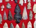
Beginning approximately 10,000 years ago, at the close of the last Ice Age, the last great herds of big game in the southwestern Appalachian foothills began to disappear. They were decimated by extreme weather changes as well as human hunters. What remained were smaller animals which lived in droves of fewer numbers and kept to a more defined territory. This reduction in both size and population forced the earliest Americans to learn to hunt by stalking. Such a drastic change in food supply produced a need for more efficient hunting tools and a more proactive social system to ensure group survival. The first of these so-called Early Archaic people (8000 BC to 6000 BC) lived in small groups and spent only short periods of time in one place. They relied little on plant foods and totally eschewed fare from the Big Sandy and its tributaries. A few groups of these foragers set up camps on Floyd County ridgetops and mountainside benches some 8,000 years ago. They were probably passing through on their way to a southern winter settlement since an autumn expedition to collect forest nuts would never have extended so far as remote eastern Kentucky. No doubt, too, these Archaics already knew what the first white Appalachian settlers learned anew: travel by foot was easier and faster atop the dry, semi-level mountains and ridges than on rocky, sandy, muddy, brush-laden creek and river bottoms. They had found a convenient use for the gaps which had been formed millions of years earlier.
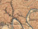
It was several thousand years before other visitors to the Big Sandy country again left evidence of their presence. These Late Archaics, 3000 BC to 1000 BC, lived on the banks of Levisa Fork at present-day Fishtrap. Their lifestyle had changed little from those who camped on the Floyd County mountaintops ages before. They were travelers who stayed only while weather and nut supplies were favorable.
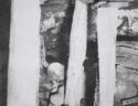
When the Christian religion was struggling for converts in the Holy Land, half a world away a Middle Woodland group was living along the Big Sandy in Johnson County near the future location of Paintsville. The most distinctive surviving feature of their culture were two mortuary mounds which were excavated nearly two millennia later.
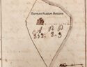
Nearly 500 years before Christopher Columbus made his rounds among the royal courts of Europe’s southern coast looking for money to finance a voyage to India, another social group was living along Levisa Fork in the Pike County area of Fishtrap. Like the white settlers who displaced them hundreds of years later, many were farmers. They ate corn, fish, mussels, deer, and smaller game. These people were more technologically advanced and had interests more suited to a sedentary lifestyle than those who preceded them further downstream. Many of their contemporaries in eastern Kentucky lived under rock shelters, but the Fishtrap settlement was a circular camp nearly 115 feet in diameter. It was walled by a log stockade.
The Late Woodland culture, the academic label given to these people, faded and disappeared. It was replaced by groups with more complex social structures and a more centralized government. White explorers met the descendants of these people and gave them the more familiar tribal names of Shawnee, Cherokee, Wyandot, and Miami. These tribes regarded the area of the upper Big Sandy as just another stretch of territory to be covered and sometimes used it as a temporary campground in their journeys. Trails used by these tribes ran through Pike County. Quests for intertribal domination as well as ultimately futile raids against the white invaders who thinned their hunting grounds began near what is now Portsmouth, Ohio. Tribes traversed smaller streams southeastward until they reached the Big Sandy River at the mouth of Middle Creek in present day Floyd County. From there they followed Levisa Fork upstream. Some came to the mouth of Beaver Creek at modern Allen, Kentucky, then took Right Beaver Creek into modern Letcher County to the North Fork of Kentucky River, then south through Cumberland Gap. Others took Left Beaver Creek to a conveniently sloping trail up Hen Pen Branch to buffalo trail just below the ridge top to Payne Gap, through Pound Gap, and into Virginia. Another main trail came to the mouth of Shelby Creek, then up the length of that stream and over the gap onto Elkhorn Creek. Elkhorn led to Pound Gap, which crossed into present day Virginia. These warriors often used an alternate trail which took them up Russell Fork through the Breaks of Sandy, the same route Daniel Boone used in November 1767 when he first set foot in Kentucky. A third path reached Virginia by way of Tug Valley. This was the route which guided the red warriors in the raid that resulted in the enduring saga of Jenny Wiley’s capture, bondage, and ultimate escape. Yet another route veered across Payne Gap at the head of Elkhorn and followed the North Fork of Kentucky River downstream to Cumberland Gap to the Cherokee country.
Through Native American hostilities and the massacre of whites, and even over the course of the American Revolution, actual battle kept its distance away from the upper Big Sandy Valley. Few white scalps were taken in the region and few red men lost their ears to the whites. The battles of Bunker Hill, Kings Mountain, and Yorktown were fought in faraway places, known only by second-hand stories in the lands west of Cumberland Mountain. Veterans who had served in the Continental Army to help win American independence arrived later with personal accounts to tell. But for the land inhabited by the first settlers, war was indeed a distant affair. Two to three generations passed before the descendants of those pioneers felt the sting of armed conflict.
Beginning in the mid-1780s, land in the Big Sandy country was parceled out under the Virginia land grant system. Revolutionary War veterans from Virginia’s militia were often rewarded with grants of land in her western counties, but it was the civilian land patent system which served a dual purpose. With boundaries extending north to the Ohio River, west to the Mississippi, and south to the modern Tennessee line, her public land west of the Appalachian divide was made available to settlers. Virginia stood to gain inestimable income from the nominal patent fees and pay off the bulk of her Revolutionary War debts, but the most immediate benefit of the land patents was new settlers. Driven by the lure of cheap land, Virginians began to slowly push the Native American hunters of Kentucky County further west. Once the natives were no longer a threat, even more settlers followed, building towns and developing commerce, all of which created new avenues for levying taxes. The Virginia grant system lasted only a decade in the counties west of Pine Mountain. The isolation, inaccessibility, and a generally insurmountable geography led to the formation of a new state.
Kentucky became the fifteenth member of the United States on June 1, 1792. Due to its rugged terrain and the continual fear of Indian attacks, the Big Sandy valley had few residents at the time. On August 20, 1794, General Anthony Wayne’s victory at the Battle of Fallen Timbers finally eliminated the threat of Indian hostilities and opened the door to unfettered westward expansion from Virginia and North Carolina. The Native American hold on the Big Sandy country ended with the death of the chief who had captured Jenny Wiley. The story of his death struggle was retold by Henry Scalf:
The symbolic end was in Red Bush Gap of Big Blaine Creek, when the old Cherokee Chief, who had helped carry off Jenny Wiley, died under the knife of James Skaggs, a pioneer. Disemboweled and dying after a treacherous attack upon Skaggs, he chanted his Death Song and implored the Great Spirit to keep the land for his people. Perhaps no other valley in America was surrendered by the Indians with as much regret.
Native Americans were not the only living creatures driven from the Big Sandy country during the final decade of the Eighteenth Century. Herds of American bison had come into Kentucky over 5,000 earlier, but by 1792 the massive animals lived in only three regions of the state. One of those was the Big Sandy region. They had traveled along the rivers, atop Pine Mountain, and along trails just below the summits of lesser mountaintops to enjoy the hundreds of natural salt licks which oozed from the slopes and bubbled up from the bottom lands. Soon after white explorers and settlers came to the valley, the buffalo disappeared. By the mid-1800s, the only reminder of their presence was a lower Johns Creek tributary called Buffalo Creek.
Once the threat of attacks by natives was erased, the eastern tip of Kentucky experienced a relative rush of immigrants, or at least a moderate trickle by Bluegrass standards, when compared to the numbers before statehood. At that time, most of eastern Kentucky was part of Mason County. Floyd County was formed in 1800 from parts of Mason and neighboring counties, but it had in effect been an entity of local government much earlier. The entire Kentucky side of the Big Sandy Valley was contained within Floyd County. There were nearly 1,500 people living in the district at the beginning of the nineteenth century.
The first two decades of the new century saw Floyd County’s population grow. It was modest growth, however, because the bulk of pioneer migration was aimed at Cumberland Gap and the rolling land of central Kentucky. Three principal routes were used by early settlers into the upper Big Sandy and the future Kentucky counties of Letcher, Pike, Floyd, and Johnson, as well as neighboring Logan County across the river in western Virginia: by way of Tug Fork on the northern border; down Levisa Fork out of Tazewell County, Virginia; and the mountain passes to the southeast. Further downstream, Lawrence and Wayne counties, and later Johnson and Boyd, were served more by Ohio River traffic than by the overland routes feeding the headwaters of Big Sandy.
The Virginia system of land grants took on a new appearance when Kentucky became a state in 1792. Under the first phase of Kentucky grants, Reverend James Madison surveyed and claimed nearly 32,000 acres of land in what eventually became Pike County. His holdings were widespread and included boundaries on Tug Fork, Wolf Creek, Blackberry Creek, Shelby Creek, Russell Fork, Levisa Fork, Pond Creek, and Elkhorn Creek. The following year, beginning with a 2,000-acre grant on the Big Sandy River, John Graham began to patent land in Floyd County. Over the next few years, while at least four dozen Floyd Countians were helping America fight the War of 1812, Graham filed over 90 claims and eventually came to own over 17,000 acres of Floyd and future Pike County property. There was an increasing number of patents each year, but nothing to compare with those of Madison and Graham. The people who were settling eastern Kentucky land were shaping the country in the fashion of the settlements they had left behind.
Floyd County was much like its Virginia predecessors. Some of the main attractions of the county seat were the stray pen beside the courthouse as well as the stocks, whipping post, and pillory in the public square. The most noticeable characteristic of the county itself was its sheer size. Floyd was developing itself by fits and starts, but for many this was unsatisfactory. Citizens of the outlying regions were making plans for the future, and these plans did not include Prestonsburg as their county seat. Isolation, the same factor that caused Kentucky to break away from Virginia, was the motivation for their actions. Residents of the eastern section of Floyd County found that a horseback round trip to the courthouse required four days in good weather. In any weather but good, it was nearly impossible. Citizens of this area demanded more accessible local government.
Lawrence County was formed from part of Greenup and Floyd on December 14, 1821. It was named for Captain James Lawrence who commanded the USS Chesapeake during the War of 1812 and had the distinction of being home to one of the first Big Sandy valley settlements. In 1789, Charles Vancouver established a fort at the forks of Big Sandy. He named the outpost for himself. Native Americans did not take kindly to Fort Vancouver’s residents and soon persuaded them to move elsewhere. Twenty-six years later, in 1815, Frederick Moore established the town of Louisa in the same location.
Pike County, named in honor of Zebulon Pike, was formed from part of Floyd County on December 19, 1821 and was the state’s seventieth county. Kentucky’s newest addition was bordered by Virginia to the east, Perry County to the south, and Floyd to the west and north. The Tug Fork of Big Sandy was the northern boundary between Pike County and Virginia. Pine Mountain rested squarely between Pike County and Virginia to the southeast. This new county eventually became Kentucky’s largest.
Like Floyd before it, Pike County’s first few years were confusing times marked by a search for stability. The original county seat, given the romantic name of Liberty, was located near the junction of the Russell and Levisa forks. No courthouse was built and little official business was done there. After two years of fussing over its location, an alternate site was selected. The new county seat was several miles downstream, diagonally across the river from the mouth of Lower Chloe Creek. Within 20 years, this proved to be a most fortunate choice; steamboats would have never been able to navigate as far upstream as Liberty. By early 1824 a town called Pikeville was laid out on the new location. A year later the county’s first post office was established there. It was named Pike, obviously in deference to the county it served rather than the wide spot by the river on which it was located. Four years later the post office was renamed Piketon, reflecting the fact that the town had started to grow. The post office continued to carry the name Piketon until after the Civil War, but the town would always be Pikeville. Such changes in attitude and shifts in direction were reflected by the county’s early population.
The upper Big Sandy region which eventually became Pike County, much like Kentucky’s relationship with Virginia, was an unofficial county long before it was recognized by the Kentucky legislative assembly. The Sandy Precinct had been a subdivision of Floyd County government since at least 1809. In 1814 there were two voting precincts in Floyd County, the Kentucky Precinct and the Sandy. The Kentucky included what we now know as Floyd County while the Sandy took in modern-day Pike County. The center of gossip and government for the Sandy Precinct was the polling place at the home of Justice of the Peace James Ratliff at the mouth of Shelby Creek. On Monday, November 19, 1821, Cader Powell, a resident of the Sandy Precinct, came before the Floyd County Court and presented his list of taxable property for the year: one tithe, one horse at $50, and 300 acres of second rate land at $800. It was the last time Powell or any other Sandy Precinct resident would be forced to make a trip to Prestonsburg for county government business.
Letcher County followed Pike by 21 years. Comprised of parts of Harlan and Perry counties, Letcher was established in 1842 and named for Governor Robert P. Letcher. Whitesburg was chosen as the county seat, but the most recognizable place name in the county during the years after its formation was Pound Gap. That saddle atop Pine Mountain was traditionally, if not officially, made the Pike-Letcher county line.
Johnson County was created in 1843 with Paintsville as its county seat. One of the earliest writings regarding travel along the Big Sandy involves a mention of the future location of Paintsville. It came from the correspondence of Captain William Russell, head of a Virginia militia company, who was stationed at the mouth of the Kanawha River in 1775. Russell wrote to Captain William Fleming on June 12 and detailed his plans for driving livestock up the Big Sandy:
I am this morning preparing to start off our cattle up Sandy, and expect that the command will leave this Wednesday or Thursday at farthest and shall decamp myself with a convoy to the other stores next Monday, and expect to overtake the stock at the Big Painted Lick about 60 miles up Sandy.
This seemingly insignificant letter was a result of nearly a year of activity which began on July 12, 1774. On that summer day, Governor Dunmore of Virginia ordered a force of 1,000 militiamen to be mustered for a march to southern Ohio. The force of citizen soldiers was meant to be an alternative motivator in the case of failure of the governor’s planned peace overtures to the Shawnee, Mingo, Delaware, and Ottowa tribes. This coalition had for the past several months been revenging the murder of Chief Logan by killing Virginia settlers in the Holston, Clinch, and Big Sandy headwaters areas of southwest Virginia. Russell commanded a company from the upper Holston and Clinch, many of whom would live to see the day that they were part of Tazewell County, Virginia. Fleming headed a company of Botetourt County men.
Following Dunmore’s order, companies formed and marched until early fall. Chief Cornstalk, nemesis of the westward-looking white settlers, not only refused Dunmore’s peace overtures; he beat the governor’s army to the punch. During the early morning darkness of October 10, 1774, he led between 800 and 1,000 warriors across the Ohio River just upstream from the camp of Dunmore’s militia. Two men from Russell’s company stumbled upon Cornstalk’s force, one of whom was killed. The second escaped to warn his sleeping comrades. Within minutes, the Battle of Point Pleasant was under way. The first shots were fired before dawn, the final rounds after sunset. As Cornstalk’s braves escaped across the river during the night, it marked the beginning of a year-long lull when hostile Indians stayed north of the Ohio River, posing no threat to the settlers of western/southwestern Virginia.
Local historians have traditionally given Anthony Wayne victory at Fallen Timbers as having opened the Big Sandy valley to settlement, but, in fact, it was the Native American defeat at Point Pleasant. Russell’s note to Fleming, when read in context of Lord Dunmore’s War, as the action into Ohio became known, implies several points of interest for the Big Sandy Valley. First, by that date, the river had been named. Second, certain features along the Big Sandy had by then become well known among travelers. Third, the cattle Russell referenced were undoubtedly headed for Russell’s Fort near present-day Castlewood, Virginia, and would not have been sent by the Big Sandy route unless the fear of attack by an unmanageable number of Indians had been eliminated. Almost two decades passed before the Battle of Fallen Timbers finally erased all fear of Indian attacks, but at that time the Big Sandy was relatively safe to travel. Fourth, the river had been followed often enough that the distances between the mouth and such locations as the Big Painted Lick were well known. A year before the birth of the United States, the future location of Paintsville was a recognized landmark.
Boyd was the final Big Sandy county formed before the Civil War. Named for Linn Boyd, a prominent Kentucky Congressman, it was formed in 1860 from parts of Greenup, Lawrence, and Carter counties. The county seat, Catlettsburg, was situated at the mouth of Big Sandy. It was simply called The Mouth by those further upstream as often as by its proper name. Going to The Mouth for store goods was a common reason for a trip downriver at mid-century. In 1858, the town became home to the only newspaper on the western bank of the river. The Big Sandy Advocate went into circulation under the direction of publisher James J. Miller, a staunch Whig and associate of Governor John B. Floyd of Virginia.
By the time the decade of the 1860s was under way, the Kentucky side of the Big Sandy had been divided several times in order to honor national and Kentucky figures. One insightful observer stated that every time a new governor was elected, a new Kentucky county was formed. The counties were established and the political machines which ran them were firmly in place. The Southern Democrats were more influential in the upper valley. Moderate elements were more common further downstream due to the exchange of news and exposure to diverse ideas among the river traffic. Radical abolitionists held few, if any, major offices and avowed Republicans were but a small percentage of the populace. The majority of men in the valley had never known a better standard of living than that which they enjoyed entering the new decade. They would have been perfectly satisfied to continue their lives in the tradition of their forebears.
Randall Osborne, August 14, 2021